Sunday 3 January 2016

An Oyster Very Rich in Pearls

In his "Personal Notes in Conclusion" at the end of his Coast to Coast Pictorial Guide, Alfred Wainwright encouraged "any walkers with initiative" to "plan his own itineraries simply by linking the public rights of way recorded on current issues of the 1" Ordnance Survey maps."  He went on "You may follow high level tracks over the hills; or circuit mountain watersheds; or march the boundary of your county or any other; or trace old drove roads; or go from point A to point B, whether A and B are castles,stone circles or whatever; or visit your maiden aunt in Bognor; or cross the country on canal towpaths; or follow rivers from source too sea."  Well I walked his Coast to Coast anyway but went on to take him at his word and in the absence of a maiden aunt - in Bognor or anywhere else - I chose to circumnavigate the Staffordshire Moorlands that are so close to home.


You'd think that a walk that took in dragons, a Knight of the Round Table, a bottomless pool inhabited by a water-sprite named Jenny Greenteeth, rocks shaped like a lion and (allegedly) a bear and a sun that sets not once but twice would be a walk through Middle Earth rather than Middle England.  That you would find traces of Bilbo and Frodo Baggins rather than Bonnie Prince Charlie and William Morris.  That such treasures could not be hidden away in an oft-overlooked area partially excluded from the National Park status of the countryside to the east and north.

But this is a walk through the Staffordshire Moorlands that will surprise those people who may not even have realised that Staffordshire had moorlands and may even surprise those who did. It's a walk that takes in the delights mentioned above, visits the few "honeypots" that the area has to offer (Dovedale, Hartington, Alton - albeit avoiding the eponymous Towers) and also explores some of the region's best kept secrets.

Essentially it is a walk alongside the three rivers that border the Moorlands - the Dove, the Churnet and the Dane - but if you hanker for the higher ground it is never far away and there are hills, clouds and Roaches to climb.  There are also the bright lights and hotpots of such traditional market towns as Ashbourne and Leek (the self-styled "Queen of the Moorlands") for those who yearn for an occasional break from the constant rural idylls.


And like Wainwright "It is a walk I recommend, not necessarily to undertake in a single journey, but in parts as place, time and weather become convenient."  In truth, that is precisely the way that I have walked it and this will become clear as the description of the route unravels.  I loved the walking but loved the research and the writing nearly as much.  "The map of England is an oyster very rich in pearls" is the last time that I will quote the great man here but is utterly true and as an oyster needs a little grit to make a pearl, so we should begin our pearl of a walk with a little gritstone...


Saturday 2 January 2016

Flash Bar to Hartington - 10 miles

The source of the Dove is traditionally recognised as Dove Head, a well-spring lying some ten yards below the main A53 Leek-Buxton road, It can be reached by a scramble over two rusty, rickety old gates and beneath some spiky brambles. And when you get there it’s a major disappointment - or at least it was on the day that I was there - as the water doesn’t appear to go anywhere and a much better case could be made for a separate spring some four to five hundred yards away. In reality, it’s a moot point. Any one of the many streams that fall off Axe Edge in this direction would have a valid claim. When the ground is wet - as it most assuredly wasn’t on that day - water just oozes its way downhill until it meets up with another stream, which joins another and another until it is finally recognisable as the infant River Dove. But a quest for the source is not to be scorned for all that. It was late March when I set out with that aim in mind. I knew it could be found without undue difficulty by finding Dove Head Farm on the A53 and crossing a stile opposite; I also knew I could climb the steep lower slopes of Axe edge alongside the river and make a more interesting route of it.

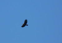
The latter way was harder, but infinitely more rewarding. A fortnight of unseasonably warm, dry weather had made things a little easier, leaving the ground underfoot firm and dry - even the normally marshy areas were no more than spongy. Bees and butterflies made their first appearances of the year and would no doubt pay for their impertinence in the frosts that would surely follow (although it would be a further fortnight before winter reasserted itself, and then only briefly). The flanks of axe Edge itself were aflame over to the right - whether by accident or by design for grouse control purposes was hard to say - and the sun beat down strongly enough for me to be clad only in short sleeves for the first time since the previous October. As I climbed past pussy willows stunted by a combination of strong winds and a harsh environment a curlew flew up from in front of me, silhouetted beautifully against the deep blue sky as it circled around, its curved beak open as its song bubbles in imitation of the crystal clear stream it had just left behind. As I climbed higher I was able to watch it come out of its holding pattern and come in to land at the very spot it had left, to be immediately swallowed up by the coarse grass that had camouflaged it so well beforehand.
Over to my left a flock of lapwings performed aerial manoeuvres, climbing high before plunging, twisting and turning back down towards the ground, pulling up from their dive at the very last moment, before repeating the process time and time again. It’s an incredibly appealing bird to watch, with its rounded wings, greenish-black and white colouring and triangular crest and one which I find impossible to watch without a smile on my face.

A myriad of tiny rivulets cover the hillside, two or three of which have cut deep gashes into the gritstone, gashes in which the water runs crystal clear despite the deep red of the bedrock. It’s the very clarity and purity of the water that leads me to question one of the theories I’ve seen about the origins of the river’s name. This is the suggestion that it takes its name from the Celtic “Dubh”, meaning Black River - which could apply to many of the peaty streams in the area but I can’t see it applying here. Much more likely, to me, is the “Roman” theory which suggests that it takes its name from Deva, the Roman water goddess - in the same way that the River Dee does a few dozen miles away in Cheshire. As I climbed higher, conditions underfoot became progressively harder, grass consisting of thick tussocks on which it would be easy to turn an ankle. And while it didn’t make for easy walking, it did lend a semblance of difficulty to the walk that would not have been there had the A53 alternative been taken - and the search for the source of any river should surely contain a little hardship. Views are limited here to the hillside above and the valley below - not a particularly attractive valley but, at this time of the year and with spring in the air, it warms the heart. A few weeks earlier, with rain falling in sheets and the wind whistling through the most technical of technical clothing, it would be a bleak and cheerless spot - the road above is almost unfailingly the first in the county to be closed by poor weather. But thoughts today were of the long hot days of summer to come; of balmy afternoons and of sultry evenings; of blue skies and of parched brown fields; of blossoming flowers and ripening corn; of cricket and canoeing and friendship in The Great Outdoors. In short, the first day when the lengthening of the day becomes inevitable once more and the need to be out and about in the freshening air becomes an absolute imperative - the first day of the year that absolutely demands your presence and won’t take no for an answer.

 Beside me the water continued to trickle downhill, in a groove that has been carved out over the years by volumes way in excess of today’s meagre offerings. At one point the path drops sharply to cross the stream as it cuts a deep canyon through the peaty soil and heads off across the slope. It’s easier to carry on uphill though, than to try to follow too close to the water itself - sooner or later the river will come back to you and to try to follow each meander would be to double the distance you’ve walked - and however pleasant the afternoon, there is always the desire to conserve energy. The curlew flew up again, almost from beneath my feet on this occasion and I was reminded of the reasons for this Winter’s increase in the numbers of nesting birds. In the Foot and Mouth spring of 2001 the eggs of birds such as curlew, plover and lapwing were pared the normal trampling that they would receive from people such as myself and (more importantly, for they are bigger and less aware of the damage that they do) cattle. As a result the normal ratios of successful fledglings were exceeded. Birds of prey also prospered and fed well on Nature’s largesse but in spite of this the numbers were up for the first time in years. Only time will tell if the tide has truly been turned for these delightful birds but the old phrase about an ill wind is once again shown to be true. Farmers would quibble at this, as well they might for the epidemic was but another nail in the coffin of agriculture up here n the high moors. It’s always been a subsistence industry - on-one gets rich on the pickings from this harsh and infertile land - but with imports and falling milk prices and BSE and so on most farms hereabouts have been loss-making for years, surviving only on grants and overdrafts. Many have taken the chance to become more environmentally friendly or organic or have diversified completely. Within a couple of miles of here are at least two llama farms, a mushroom farm and many that receive grants to leave land uncultivated and free of herbicides and so encourage wildlife.

Life is hard here but by working with Nature rather than fighting it, it’s possible that there is a future as well as a past for these lonely buildings. Having said all of which, Dove Head Farm is scruffy, unreconstructed and completely uninspiring. Unfortunately, it’s situation right alongside the main road is frankly depressing - the cathedral of Notre Dame, the British Museum, Edinburgh Castle, drop any of those so close to the A53 and they’d struggle to look their best too. But I can’t help feeling that they’d have made a bit of an effort to tart themselves up, which the farm doesn’t seem to have done. Instead it’s let itself go big-time and there’s probably no going back now. To think that one of England’s most aesthetically-regarded rivers emanates form a spring just the other side of the road from here seems a little out of place somehow. The Nile rises from Lake Victoria; the Ganges from high in the Himalayan foothills; even locally, the Lathkill pours from a delightful little limestone cave before flowing away through a landscape not dissimilar to parts of Dovedale. But if every great journey starts with a small step, the Dove’s first faltering strides are in fairly unprepossessing surroundings.
And then you pick up your eyes form the ground beneath your feet and take in the bigger picture and you realise that this land is a land worthy of not just one but of five wonderful rivers; a land worthy of the enormous affection in which it is held; a land that inspires devotion from those who know the area well and that will inspire the devotion of those yet to come. Big, wide skies; the wind in your hair; and a journey stretching ahead of you into the distance. It may not be the perfect beginning but believe me it’s a damn good one and although things go downhill from here (as rivers inevitably must) it’s going to be a while before you see a road with more than one track, which as good a recommendation as you can get for any journey in this over-populated country we call home. A fortnight after my walk to the source, Axe Edge went up in flames as a result of the combination of a lack of rain in the atmosphere and a lack of intelligence in the idiots who thought it a good idea to drop a match or two. Over the course of one Good Friday night so much of the good work in habitat preservation was undone by an act of sheer stupidity.

I was always a little confused about the two birds that I now most closely associate with the wild and windy moors of Axe edge - the curlew and the lapwing. The reason being their common inclusion in the estuary/waders section of bird books. If they were waders, or if they lived on estuaries, then why should I look out for them in the higher lands of the English Midlands, as far away from the coast as it’s almost possible to get in these islands of ours. The truth is, of course, that they vary their habitats and are often to be found wintering at the coast where tidal flows ensure a regular diet of worms and (in the curlew’s case) small molluscs.
But if they do have coastal tendencies it is in this moorland environment that they most soar - both literally and metaphorically; here that they are most truly at home. This achieves recognition with the inclusion of a curlew in the coat of arms of Leek and the Staffordshire Moorlands, seen at its best on the beacon below the Mermaid Pub on Morridge, two or three miles away. And if it seems strange for estuarine birds to be found here, how strange it is to find a mermaid as one of the five pubs in the country highest above sea-level. It takes its name for Mermaid Pool a few hundred yards away, an apparently bottomless pool that eventually becomes saltwater and joins the sea and has provided shelter to the eponymous sirens over the years. Across on the Roaches is to be found a twin in Doxey Pool, home to a water monster if Victorian tales are to be taken as fact. If true, of course, this gives the birds a short-cut when they tire of paddling around wave-ridden beaches and yearn for the wind and rain of home. Home, for both lapwing and curlew, is a nest on the ground which obviously has consequences for the eggs that they lay and the displays that I described earlier are part of their protection policy - by creating a diversion, attention is distracted from the nest to the parent and if it works with humans, it can work with their more natural predators - foxes, weasels, stoats and so on. Both utilise small “scrapes” in the ground and have suffered as a result of changes in farming practice - specifically the change from spring sowing to autumn/winter planting. This results in longer grass over the important nesting period and not the short stubble that they prefer and have grown used to over many hundreds of years. Happily, awareness of this has grown and with payments for environmentally friendly agricultural practices becoming increasingly available, numbers which had fallen by 50% over the last fifteen years are starting to show signs of recovery. A similar fall in numbers of lapwing in the 1800s was due to the fashion for their eggs as a delicacy - those days are long-gone thankfully, helped in no small part by the Lapwing Act of 1926 in which Parliament gave them special protection. One of the reasons for the popularity of the bird is their ease of identification. Each has a particular characteristic that means it stands out from the crowd and even the least competent of ornithologists (and I include myself in this) can point them out with confidence. The curlew’s long, drooping beak means anyone struggling with its unshowy brown and white markings has no excuse for confusion. Likewise the lapwing’s curious crest makes it unmistakable - there is something undoubtedly comical, too, in its strutting walk. Surprisingly both have been linked with premature death. A number of mining tragedies over the years are alleged to have been presaged by visitations by flocks of lapwing and the eerie cry of a curlew is reckoned an omen of evil in communities as far apart as Shetland and Devon. With increasing appreciation of Nature for its own sake, these old-fashioned beliefs are now viewed as mere superstition but while the sight of a curlew in flight will always lift the heart, its call is undeniably mournful whilst the lapwing’s alternative, onomatopoeic name of peewit comes perilously close to the cry of “bewitched” with which it was oft-times linked. Whatever the history, though, today these birds are deservedly much-loved and as the first birds likely to be encountered on our journey downstream are welcome as precursors of the ornithological pleasures to come.
A week after the walk to the source described earlier, I was back, making the most of the continued dry spring weather. Again I parked by Flash Bar stores and dropped sharply downhill to the single-track road that serves the two or three farms hereabouts. Just before the road turns uphill again the stripling Dove flows underneath, neatly contained within a couple of largish drainpipes, and strikes out in a vaguely south-westerly direction heading unerringly for a narrow V-shaped passage through the hills. Of course if you stop to think about it you realise that the reason for the valley being there is the many millennia of hard work the Dove has put in eroding its way down through the gritstone bedrock. This bedrock ensures that the land to either side of the river retains the acidic character of Axe Edge - although the land is nominally agricultural, no crops grow here. Sheep and cattle fight a constant battle to eke out a living for those farmers too stubborn to realise the long-term futility of their efforts - if the land doesn’t defeat them, it seems the forces of the market economy will. When that happens it will be a sad day for the county but there appears to be a certain inevitability to what I suppose we must call progress. Even now the umber of derelict farm buildings is an inescapable fact - given a greater poignancy by the manner of their construction. Stone barns, cattle byres and sheepfolds stand testimony to the care and pride with which their owners built them - building for a future that is now long gone. These buildings are a part of the landscape, almost a part of the land itself in a way that modern buildings only rarely aspire to. Our loss.

The public footpath here crosses a number of fields, occasionally drifting away from the river itself but always following a near parallel course. At this stage in its existence the valley is so narrow as to make a path immediately alongside an impossibility - in places the gritstone has been eaten away to create little gorges through which only water can pass; in places mud lies thick and willow and ash grip tightly to the banks, creating thickets so all-encompassing that light and heat are excluded and forming their own tiny microclimates. A harsh land, then, a desolate land; a land of bracken and gorse; of stunted hawthorn and coarse marsh grass; a land where even the trees carry a thick covering of lichens and mosses; a land where survival depends upon the ability to make the most of what meagre sustenance can be found. But nonetheless a beautiful land, peaceful and calming; a land of birdsong and stillness; and of a silence you can almost hear. (As I sat writing this I was disturbed by - successively - a dog, a young boy, and his parents. Within seconds they had gone and I was alone again, miles from anywhere, with only my thoughts, my pen and my paper for company. A wren chirruped in the dry stream-bed below me; a rook cried out from the trees across the river; and a skylark trilled overhead. But for the plane flying high above, nothing had changed here for years it seemed.) In the lee of one of those farm ruins that I mentioned grew a clump of daffodils, whilst inside what was once the main room birch trees sprouted - nature taking back what it had once lost - and I sat and thought that this must mean something but could think of nothing beyond that it was beautiful.
After a much longer pause than I had originally intended I set off along my route once more. In a short while the path drops sharply, steeply downhill, the temperature dropping in sympathy. The water cuts its way through one of those rocky gorges, revealing the different strata as it does so and thereby revealing its age - for a relatively young river it has flown since the time of Methuselah and beyond. Roman warriors strode the hills and saw the same scene spread before them. Angles, Normans, Saxons alike. This river has flowed throughout history and will continue to flow, long after you or I have gone. The valley itself is choked with woodland, birch predominating with oak and ash as companions. The pathway itself is riven with roots, and branches tug at your rucksack as you pass. This is not a place to linger after dark if you are of a nervous disposition. Further downstream are to be found woodlands you would find in the books of Enid Blyton, woodlands where you could imagine the existence of a Magic Faraway Tree; this is a woodland of the Brothers Grimm, of the darker parts of Tolkien, of childhood nightmares rather than childhood dreams. These are not beautiful trees, not in the traditional sense. Like the people of the moorlands they are shaped by their environment. Life is hard down here, little light penetrates, there is water in abundance (often in over-abundance) but the soil is too thin and bare to sustain anything like a comfortable existence. It’s perhaps for this reason that parasitical plants and epiphytes - ivy, mistletoe and so on - seem to thrive. These plants take their nutrients not from the soil but from the parent plants on which they live - mistletoe, for instance, is particularly linked with oak; ivy thrives on many different trees; and mosses or ferns are unfussy about their habitats. Wherever they lay their roots, that’s their home.

 It’s something of a relief when the path turns its back on all of the gloom and makes its tentative way back uphill. It’s not too far away from the river and it’s not for too long but when it drops to the waterside again, it is a completely different picture. The path is suddenly paved and wends its way between dry-stone walls, heading towards a low single-span bridge taking the path back into Staffordshire - the Dove is already by this point the county boundary. The bridge goes by the name of Washgate and is an old packhorse bridge dating back many, many years to the time when packhorses were the juggernauts of the day and “jaggers” the Eddie Stobarts who operated the trains of up to fifty or sixty at a time. The proximity of the Cheshire salt mines and the Macclesfield silk mills give clues to just two of the wares that would have passed over the bridge - its walls being kept deliberately low so as not to prevent the passage of the low-slung packs carried by the horses and mules. The narrowness of the bridge also serves a practical purpose, as to build any wider than a mule would have been a mere waste of energy and resources. The walls, built of whatever local stone lay near at hand, are now moss-covered and green and as much a part of the living environment as the trees and undergrowth that they hold back from the pathway itself.
The packhorse trail crosses the bridge and heads off steeply uphill, away from the ruined cottage that would once have provided the jaggers with food and possible shelter for the night. My peace was briefly disturbed that day by the appearance of a round half-dozen motor cyclists on their noisy equivalent of mountain bikes as they scrambled in and out of the valley at maximum speed and volume before leaving me to cross the bridge and left over a smaller wooden footbridge across a smaller tributary stream and away, slightly uphill along a narrow path as it clambered up the slope and around the corner to reveal a more open valley now. The river sweeps gracefully away to the left, the path now making its way through open fields towards yet another atmospheric ruin - this time the loneliness emphasised by the large birch tree that grows through the barn’s wall and will surely cause it to fall one day in the not too distant future. The way is slightly sunken and shaded by an avenue of mature trees which leads me to believe that it once had a close connection with the Washgate building - it is easy to imagine that an alliance would strike up between the families that lived out here so far from their other neighbours and that such an avenue would make their solitude a little less apparent.

 As I sat and ate my sandwiches and drank from my flask I became aware of another presence behind me. Nervously - for I was miles from anywhere and was at that moment pondering on how eerie the spot would be during the hours of darkness - I looked around and saw a beautiful large snow-white carthorse loping towards me. I had had a similar experience with Mike, an old walking friend, some years previously when a horse we had named Tir Na Nog (after a horse in the film Out Of The West) had followed us for a good half-mile or so having spotted us consuming Mars bars and coffee. Conscious that I had only one chocolate bar, and had been looking forward to it, I hurriedly packed up and left, glancing over my shoulder as I did so to make sure that I wasn’t followed. The horse had come to a halt and followed me only with his eyes, a slightly hurt look on his face as though he were disappointed in me. Feeling slightly guilty I did my best not to meet his eyes and turned my gaze instead to the views ahead.
I shall talk of Chrome and Parkhouse Hills as we make our way downstream but will only pause here to say that they attract the eye from miles around but - forming the far side of the now-wide valley - in profile are a fine sight and demand your attention. Rowan trees provide a fine foreground and birdlife trills and sings but are unable to distract you for more than a second or two at a time. It is fortunate that the way soon heads for a clump of trees and forces you to duck low to avoid a nasty poke on the eye, or you would soon be tripping over your own feet for all the attention you are paying to the path ahead of you. More horses appear, and cattle drinking from the myriad of tiny springs that come to the surface here - something to do, no doubt, with this being the end of the gritstone above and to the right and the start of the limestone to our left. Indeed, the land to the left and below was once the bed of an inland sea; Chrome and Parkhouse Hills, coral reefs that lay below its surface. Of all the little snippets of information that I’ve picked up about the area over the years, it is this one that I find the most mind-blowing and that makes me feel the most insignificant.

Thinking on this little detail I made my way to the open gate above me and the one-track road into the village of Hollinsclough. Daffodils were in bloom and tiny goats wandered in front of me as I reached the main square of the village. The Methodist chapel, a rather plain square building in keeping with the religion, brings a grandeur to the place that would otherwise be missing. It’s a quiet, undemonstrative spot- gritstone stolid rather than limestone pretty - and I rather like it for that. The abundant daffodils soften the edges a little but it’s a village that will never feature on the front of a chocolate box. But lift up your eyes and look around you. You haven’t seen a sky this big since you left the source of the river; you haven’t seen a skyline like the one opposite this side of the Dolomites; and you haven’t even scratched the surface of the delights this river will provide you with. Time to take a breath, enjoy the spring sunshine and look forward to the joys to come.

Having a big sky to look at once more, my eyes were caught by the sight of a kestrel, hovering high above a field over towards Longnor. Whilst it is the most common of Britain’s birds of prey - at least of those that fly during daylight hours - and even a short motorway journey will bring a glimpse of one if you’re looking, the sight of these beautiful falcons is still greatly to be enjoyed. Whether perched on telegraph pole of tree branch, shoulders characteristically hunched; in soaring flight with wings outstretched; or hovering to draw a bead on its unwary prey, there is a natural grace to the bird that makes you root for it even as it drops like a stone to grasp a cute little vole or mouse in its cruel talons. It isn’t a large bird - little longer than a lapwing - and like other falcons hasn’t a particularly long wingspan either. When hovering, these pointed wings beat in a bur of activity, its long tail providing stability, acting as a rudder to steady it against the wind’s buffeting. The commonly used alternative - windhover - is a more poetic name that accurately describes the bird’s chief characteristic, whereas “kestrel” is an allegedly onomatopoeic description of its “ke-ke-ke” cry. If this is true it is strange that the more common name describes a much less obvious characteristic - those of us who love and admire kestrels do so for their appearance rather than their “song”; it is like calling a woodpecker a “tchich” for the call note that it makes. Whilst it is difficult to tell when viewing from below, looking up at the bird silhouetted against the sky beyond, the wings of a kestrel are of a glorious reddy-brown, with a body of grey in the male and a duller brown in the female. Stand high on a hillside, though, and look down on them from above and their beauty is more apparent still. As they exist on a diet of small mammals in the main, kestrels have never featured greatly in falconry circles - “a kestrel for a knave” signalling the low esteem in which they were held in the hierarchy of these things. Nonetheless, in common with other birds of prey they have attracted the ire of farmers and gamekeepers over the years and have been persecuted for their supposed taking of game birds and other small livestock. However their high visibility is testament to their ability to adapt to circumstances and with the use of pesticides and poisons in decline, it is possible that we shall see a rise in their numbers in the future.

Already showing a sharp rise in numbers is the buzzard. Larger than a kestrel, with a much larger wingspan, this is a glider rather than a hoverer. You are increasingly likely to see their broad “finger-tipped” wings circling on thermals like microlite aircraft, often in pairs or small groups for they seem more sociable than the individualist kestrels. For many years my first sight of these glorious soaring raptors (wheeling high above Eskdale in the English Lakes) was also my last but in recent years the population has recovered from its sharp decline following the myxamatosis outbreak during the 1950s, which had such an impact on its main foodstuff. It in sow much more commonplace and probably second only to the kestrel in its visibility. I have particularly strong memories of playing cricket in Newtown, Powys and Ludlow in South Shropshire and having already fine matches being wonderfully enhanced by the presence of four or five large adults regularly circling overhead, almost as if they were enjoying the cricket as much as I was - my fielding on those occasions may not have been all that it should be, although memory tells me that I still batted OK.

Like kestrels, though it is in flight that they are truly graceful, to see them at rest is also to be treasured. Whereas the kestrel is often seen on telegraph poles or wires, a buzzard is more at home within a tree (they nest in broad-leaved woodland; a kestrel does not make a nest, choosing instead to lay its eggs on cliffsides or ledges, or in a nest abandoned by other birds). When silhouetted on a large branch you can readily appreciate just how large they really are - perhaps two feet from tip to toe - and can understand how they manage to pluck rabbits and other small mammals through sheer brute force rather than the rapid “stoop” of a falcon. Two quite different birds of prey, then, but alike in their ability to entrance. In living in the early twenty-first century, we are more fortunate than our grandparents, during whose childhood they would have been well on their way to extinction. We must never get complacent about their recovery - and have seen other, equally beautiful birds disappear from common view - but should be grateful that circumstances have conspired to restore these graceful fliers to our skies and to our hearts.

Back in Hollinsclough, we’re something like a quarter of a mile from the river itself so the sooner we get back to the waterside , the better. However, as soon as we do I propose a little detour away again - although the river remains in sight for the vast majority of the time. It will bring us back to Hollinsclough, which may seem like a complete waste of the (not inconsiderable) effort expended but believe me when I tell you that it will be one of the highlights of the journey downstream. Chrome and Parkhouse Hills are - as I’ve already indicated - the major landscape features in Upper Dove country. The local nickname - the Dragon’s Back - is a descriptive one and gives a fair impression of the lie of the land. Each rises in a vague arc to a knife edge ridge before drifting down to river level and each is covered in knobbly limestone outcrops which give them their unique appeal. There is at most a quarter mile between the two of them; Parkhouse, the lower of the two, being the further downstream. Both are privately owned, although Chrome (pronounced Croom) has a concessionary path along its back - and it is this path that is the subject of the proposed detour. It was Good Friday when I awoke early with the intention of climbing Chrome Hill. I was a little nervous as I’m scared of heights and a single glance at the profile is more than enough to know that this is a place to be wary of in high winds. The left hand side has a slightly convex shape, but falls all the way down to the river; the right side is concave - indeed there is even the impression of a slight overhang - and drops into Dowel Dale, which wends its way steeply down from High Edge above Buxton through the gap between two hills and down to the main valley floor. At its end is the tiny hamlet of Glutton Bridge and from here it is clear that the dragon’s back is not the only valid description. From this angle it resembles nothing so much as a shark’s dorsal fin - a more appropriate simile than the dragon, for as I’ve already mentioned, this is not your typical White Peak limestone but an ancient coral reef from the area’s days as a tropical sea - a Great Barrier Reef of its day, which I’ll grant you was a good few years ago now. Imagine standing on the top, looking up and seeing thousands upon thousands of fish looking back down at you - it defies belief really and few of us can make the imaginative leap required to put the two pictures together. These days it stands proud as one of the few real peaks in the district - ironic, given the modern name for the area but in truth “Peak” is reckoned to come from the Old English, meaning hill, whereas “low” (as in Arbor Low or Caldon Low) means “high point”. Confused? Then don’t give too much thought to the reasons behind the landscape, just appreciate the way it looks today.
Now although it is “only” a hill, the scramble to the top from this side is not without effort, but at least the regular pauses for breath are rewarded by an ever-increasing panorama. Behind you the slopes of Parkhouse Hill benefit from this fresh perspective and to its right the Dove itself snakes its sinuous way into the middle distance. In the mid-morning the sun is directly beyond Hartington a few miles distant and prevents a clear view but the mystery it creates is enough to tempt you still further downstream - at least once you’ve finished with the detour. As you look longingly up towards the summit, down to your left the Dove wends back towards Hollinsclough in tight little meanders. From up here I could have sworn one of these had developed into a classic oxbow lake but I’ve yet to identify it on the ground. Over time the river will batter away at the inside of each meander and erode the bank away, depositing the sediment on the outside of the bend where the current is slower, until the meander itself is straightened out and the apex left as a little semi-circular lake - the “oxbow”. The whole process will then start all over again - erosion where the current runs fastest, deposition where it runs too slowly to carry the soil and a new meander will be created. In this way the course of the river runs hither and thither all over the valley floor - over an incredibly long period of time, granted - and hence carves for itself a floodplain many times wider than the watercourse itself.

So the landscape before us today, one that seems so unchanging and timeless that we seek it out specifically for these qualities, is in fact in a constant state of flux. Thoughts of this nature are far way on this glorious April morning though. For now I am just appreciative of the fact that 1)I’m not at work; 2)I live close enough to get here inside half an hour; and 3)unusually for a Bank Holiday, the weather is quite lovely and I shall not be made to regret leaving my fleece at home. But don’t get the idea that everything is perfect, for Chrome Hill contains a full set of the bane of the hill-walker’s life. Not one, not two, but three false summits which beckon you onwards with the promise of an end to the uphill struggle, before it is revealed that the real ridge remains tantalisingly out of reach. When the top is finally attained it is clear that fears of the sheer drops to either side are - whilst not entirely unfounded - at least worse in the imagination than the actuality. Surprisingly it is the seemingly shallower western slopes that give more cause for concern, largely because the path tends to skirt that side if the ridge, slightly below the actual arête itself. Views down to Dowel Dale to the right are limited to those occasions when gaps in those knobbly bits I spoke of are encountered and are both shorter and shallower than the view from Glutton Bridge would suggest. At one spot near the end of the ridge, erosion has created a window in the rock through which you can clearly see the valley on the far side - an unusual feature to find in such a place. Aficionados of coastal scenery will clearly recognise the similarities with arches such as Durdle Door on the Dorset coast. When still a tropical sea wave action will have first eroded the limestone to create a cave, then continued to work on the stone until such time as the roof becomes unstable and partially collapses to leave the arch effect that we see today. In time it would have continued to attack the weak point until the remainder of the roof gave up the ghost, leaving a stack similar to the Old Man of Hoy on Orkney. Again, easier to write about than to imagine happening in practice, for the timescales involved are near inconceivable. Nonetheless, a feature to entertain and fascinate in equal measure.

 A last short, steep and muddy descent brings us to the end of the hill but not to the end of climbing for the day, as the path immediately turns back uphill and away form our ultimate destination. While your legs will feel it, it is far from along climb on this occasion and once the top is reached it is downhill nearly all the way to river level. The access road to Stoop Farm is skirted - named, almost certainly, after the dive of a falcon to take its prey - and the change to gritstone crossed as the path to Booth Farm is taken. “Booth” is an old name for a small enclosed agricultural dwelling and booths are to be found scattered across the Peak District, the best-known being Barber Booth in Edale, but there can be few better examples than this high moorland situation. It is just a pity that it is nowadays such an ugly spot, with old and rusting machinery and vehicles dotted around the perimeter. Nowhere, too, can the difference between limestone and gritstone landscapes be more clearly seen. To the east, all is white and pretty; to the west, brown and - well - gritty.

The way back to Hollinsclough is to the south-west. A steadily falling track makes its way downhill, past a lovely old farmhouse, with views gradually appearing upstream to Axe Edge and the headwaters of the river described in earlier chapters. The hill around which the path descends is Hollins Hill and the small valley between the far side and Chrome Hill contains Swallow Brook, the first of the river’s tributary stream to be named on the Ordnance Survey map. Before the hamlet is re-encountered there is another glorious little packhorse bridge to cross. Immediately upstream is a clearly delineated ford, no doubt where the packhorse trains crossed before the advent of the drier alternative. Immediately downstream is a small weir, the first of man’s efforts to control the flow of the river to be encountered, but by no means the last. Another couple of hundred yards and we are back where we started - the centre of Hollinsclough - and able to look up once more at the glories of the skyline. This time, though, we can bask in the knowledge that we’ve thoroughly explored at least a part of the view and that it has been a splendid excursion. If all detours were this good, we’d never get to journey’s end but the siren song of the river is calling us back and is difficult to ignore.

 Having filed the detour away in the memory bank, our way downstream resumes. It is immediately clear that the landscape has undergone a major change. Instead of the stunted vegetation that has gone before, all is lush and green. Chestnut trees grow tall and spread wide, willows weep and verdant meadows are filled with more than the thistle and clover that has grown previously. This is partly the seasons at work of course, for it is now April rather than early march, but it is also indicative of the change in soil, of the change in altitude and of the river’s growing maturity. To a degree it is now the river that affects the landscape rather than the landscape influencing the river. At Glutton Bridge, road crosses river for the first time since it could be contained within the two drainpipes six or seven miles previously - a feature so significant in years gone by that it came to define the hamlet that took its name. From here, though, the path leaves the riverside, favouring the Derbyshire bank but at a quarter mile’s distance. Over in Staffordshire a long gritstone ridge keeps the Manifold at more than arms’ length for a good few miles yet.

Standing proudly atop the ridge is the village of Longnor, known to millions of ITV viewers (although not this one) as the setting of Peak Practice. I’ve an enormous affection for this old market town, now greatly diminished in significance and prestige but still possessing its wonderful old market hall, with the tolls displayed above standing testament to its historic influence. Narrow passages to either side of the market lead uphill to the parish church and graveyard, with charming little alleys diverting off to left and right. The market hall itself is now a teashop, selling and exhibiting local art and craftwork and its apple pie comes with the author’s strong recommendation after a hot and strenuous walk. The village also comes with an abundance of pubs (four of them surround the square, which is ridiculous for such a population). It is, though, undeniably more the Manifold’s village than the Dove’s and it is a strange quirk that the Dove seems actively to avoid the company of towns and villages along its course. Amongst the villages and towns that it by-passes are Hollinsclough and Hartington, Ilam and Ashbourne, Rocester, Uttoxeter, Tutbury and Burton. Only Milldale, it seems, actually whole-heartedly embraces the rover and Milldale is a mere hamlet that has acquired a level of fame only as the northern end of Dovedale itself and therefore a local honey pot around which pleasure-seeking day-trippers swarm. Visit on a long summer evening, or mid-week outside of school holidays and a peace reigns that is largely absent on Saturday and Sunday afternoons.

But to talk of towns downstream is to get ahead of ourselves and although distant from the river the path is a pleasure to walk. Hedges hem you in now, not walls, and although the walls are wonderful there is a variety to the hedgerows that holds the attention. Hawthorn, wild rose, honeysuckle, foxglove, blackberry, bindweed. Every step and every season brings another species to the fore. There is a way of calculating the age of a hedge - something like a century for every species found in a thirty yard length - but age isn’t always the important thing. Britain has lost most of its many miles of hedges over the last hundred years as automation has made their destruction both easier and more economic. As with so much of the bad news I have already imparted, attitudes are changing but they are changing slowly. It is to be hoped that the change can become more radical - from stopping the destruction to active replacement - for with each mile that is lost we lose a myriad of wildlife habitat and the countryside (and the country) is the poorer for it. After a mile or so a green lane to Beggars Bridge is reached. Across it lies a path directly to Longnor, but to take it leaves all the views behind you. Far better to approach from Longnor where all is laid out in front for your delectation and delight. For all that it has name, the bridge is little more than a plank of wood with a couple of rails either side. It will be a while yet before a bridge really worthy of the name is encountered.
Our way, though, doesn’t take this right turn, carrying on along the same track to the tiny hamlet of Crowdecote - basically a pub (The Packhorse, continuing a theme) and a scattering of houses lying below the switchback road to Bakewell. Up to the left, neatly mirroring the ridge opposite, is the limestone equivalent - High Wheeldon, the near-symmetrical terminus of the magnificent coral reef that began with Chrome Hill. There will be other, similar peaks along our way but for the time being the skyline is that of a high plateau to both east and west. It is a sharp delineation, this. Even the dry-stone walls are different - to the east, double-packed limestone showing few if any chinks; to the west, single stones piled on top of one another, defying gravity and doing their job but - when backlit by sunlight - clearly riddled with holes that the wind can exploit. If you are looking to shelter from a bitter wind whilst taking coffee or eating lunch, pick the limestone variety. The walls separate long, thin fields that flow away uphill - evidence no doubt of a long-lost style of farming. I claim no great knowledge on this point but wonder if these fields demonstrate a system which gives each farmer a share of the land, from the wettest at the river’s edge to the valley side too steep for cultivation. Certainly the fields on the Manifold side of Longnor are so thin that it suggests to me the feudal “strip farming” that I learnt about in the first year at comprehensive school - that each manorial serf be given a number of strips dotted about the village to till, a percentage of the harvest from each to be given to the lord of the manor as rent, or “tithe”. I may be completely wrong in these conjectures but am content to ponder them in ignorance - I find it interesting to think on these matters as I wander and am grateful to Mrs Slater and her ilk for instilling that questioning mind and the minimal knowledge that I may now possess.

There is more to think about beyond Crowdecote, for it is here that we come across some of the earliest signs of human dwelling along the course of the river. Firstly, and easily accessible from the now muddy track, are the remains of Pilsbury Castle. If this suggests stone keep and battlements to you, prepare to be disappointed - all that remains is the outline of the earthworks of an ancient motte and bailey style fort surrounding a limestone pinnacle. It dates to Saxon times at the very least but may even be of Iron Age origin and is in a fine defensive position to command the river - the valley narrows again at this point and anyone approaching from the north would be clearly visible. Water is obviously easily available and shelter from the worst of the weather is gained by virtue of the steep valley sides. To modern eyes it is vulnerable to attack from above, but with the weapons available during its heyday it may just have been impregnable. High up on the Staffordshire side of the valley, sitting proudly atop Sheen Hill, is the site of another ancient castle. Perhaps this offers a more easily defended position still, but there is a distance to travel for water and it undeniably bears the brunt of the bitter winds that blow across the plateau. If you fear for your safety, pick Sheen Hill; if it is an easy life you are after, Pilsbury wins hands down.

Having said which , that “easy” life is a purely relative term. A few hundred yards beyond the castle is to be found the yeoman farm of Pilsbury itself. A collection of buildings dominated by the old three storey farmhouse, this would once have been a self-contained little community a step down from the lord of the manor but owned and operated by a still-wealthy individual along fairly feudal lines. Even into the middle of the twentieth century, I understand that hot and cold running water and electricity were still lacking. Hard though it is to believe, it may not be overstating matters to say that it had more in common with the eighteenth century than it did the twenty-first.

The first time I came to Pilsbury was a freezing February morning and I was captivated by the coppice just below the house itself, the thin boughs sprouting from the trunk near ground level allowing in ample light to the undergrowth and a beautiful blanket of pristine snowdrops. These incredibly delicate flowers, first harbingers of spring, always bring to mind Paul Simon’s marvellous phrase about “a freshly fallen, silent shroud of snow”, but never has it seemed more apposite than it did that morning, with a sharp frost underfoot and the brilliant white of the petals sat upon the glorious green of the stems and the leaves. Individual flowers may be more attractive (MAY be more attractive) but there is something incredibly appealing about the effect this blanket creates that is challenged only by the bluebells of late spring or the poppy fields in high summer. More than any other natural phenomenon the appearance of snowdrops is symbolic of the rebirth of the countryside after the harsh winter weather and anyone who fails to be cheered by their presence is in need of medical attention. It foretells of longer days, of lighter evenings, and of warmer temperatures; of the clocks going forward and the return of migrant birds; of daffodils and crocuses and an end to hibernation; of the drip, drip, drip of April showers and of the brief flourishing of the Mayfly. It is a lot of responsibility for such a small flower but one it has carried off for years and will continue to do for many years to come.
But we must drag ourselves away from the coppice and head on to the building itself. A few weeks after that first visit I was passing this way again, this time in the company of friends, and was surprised to see a handwritten notice offering biscuits for sale. Surprised for two reasons - one, because so few people pass by here that there would seem to have been minimal profit in the venture; and tow, because the three young children providing the service were splitting the e proceeds between the NSPCC and the RSPCA. It would have been churlish to have passed by and not rewarded such enterprise, and at only 10p per biscuit they seemed excellent value. The pound we spent may well have been the only pound the children took all day for there seemed to be no-one else about, but their enthusiasm and delight at the sale was easily worth the minimal expense on our part. To be quite honest, if the charities saw not a penny of our donation it was still money well-spent!


 You may have noticed that we have strayed from the river, however temporarily, and it is true that for the next couple of miles the path is kept at arm’s length, with only occasional meetings of the ways. Just below Pilsbury is one of those meetings as a path drops down to what is marked on the map as a ford but is actually a bridge these days - although the “Public Footpath” sign points unerringly across the three or four feet deep water. On the far side a steep track climbs uphill to the foot of the aforementioned Sheen Hill. In years gone by this was one of the network of “salt ways”, also previously discussed. Unusually it heads straight uphill and takes some climbing - the expectation would normally be for a gently zigzagging route to ease the gradient and make matters easier for the packhorses but this is one tough twenty minutes to the top. Happily our route lies along the valley floor.

Between Pilsbury and Hartington is a gated one-track road servicing the handful of farms along the way. It’s a quiet road with scarcely a car in sight as you pass along and views are pleasant. The walking is easy but it’s still a road and road-walking is never ideal. An alternative - acceptable under the circumstances, as the river runs largely through private land - is to climb the steep slope to the left (steep, yes, but a lot easier than the Staffordshire alternative) and make your way across farm fields with grass once more beneath your feet. This route has the added advantage of a visit to another relic of an industry long-gone. Much of the limestone White Peak bears the scars of quarries both ancient and modern where the landscape has been exploited for the minerals it contains. Whether this is a curse or a blessing depends on a number of factors - chief among them for me at least is the age and the extent of the workings. Few would now argue that the Blue John mines are anything but an asset to Castleton to the north, but the Blue Circle works at Hope just two or three miles distant are nothing but as blot on the landscape due in no small measure to the enormous chimney belching out its fumes and visible for miles around. Here above Hartington the lead mining industry is no more and shafts in the immediate vicinity are now curiosities rather than monstrosities. The buildings are now ruins, with a dewpond making them a little more picturesque than would otherwise have been the case. At Magpie Mine beyond Monyash - some ten miles as the curlew flies - buildings have been preserved by local history societies and give some small inkling of life as it would have been lived a couple of centuries ago but here there is little to stir the imagination.

Beyond, though, is a rarity for Derbyshire - a limestone pavement. Small and intermittent it may be, but it is something of which Hartington can be deservedly proud. Here an outcrop of limestone has been eroded over the years by the action of water on weak spots to leave an effect similar to that of a cobbled street. The “cobbles” are known as clints; the gaps between them as “grykes” and there are often the most delicate of alpine plants to be found sheltering from the wind and rain in amongst them. It’s tempting to idle away time up here, enjoying the view back down the valley to the Dragon’s Back and avoiding the drop back down into Hartington and its tourist traps but if we’re true to the river it’s to the valley that we must return.

In truth it’s a gem of a village - a central duck pond and green, with lovely architecture surrounding it in a traditional market square. The town hall - now a general store - stands testament to the importance of the place in years gone by, as does Hartington Hall - now a youth hostel. The most important building in the village these days, though, is the cheese factory - producer of a large percentage of the country’s Stilton. It’s a link with the agricultural past, as is the local farmer’s market, but the majority of businesses locally now make their living from tourists. It’s a pity that the river is still held at arms’ length from the majority of footpaths but the best of the river is yet to come and - better still - starts just a half mile away, so enjoy Hartington and look forward to a Prince of Dales.

Friday 1 January 2016

Hartington to Church Mayfield - 12 miles

For the most beguiling section of the whole route, the way out of Hartington is not a particularly propitious beginning. It squeezes between the public toilets and a factory shop selling “character” terracotta pots before heading out across undulating fields in the vague direction of the river. After a pleasant half-mile the river comes into view from the right, meandering along in much the way that the path has done before both suddenly quit stalling and make a beeline for Morson Wood - planted by a Les Morson and family in 1994, so still an infant plantation but one that provides the entrance to Beresford Dale, where the Dove truly becomes the river known to millions. It is here that the limestone takes over completely, narrowing in on either side to create a classic V-shaped valley dotted with strange rock formations and caves, weirs and waterfalls for the next few miles until it finally leaves the hills behind and sets out on its journey through the lowlands.


The first few hundred yards within the dale feel claustrophobic after so long in the wide open spaces, and the canopy of trees overhead and the encroaching undergrowth grabbing at your ankles only exacerbates the feeling. In spring wildflowers carpet the narrow margins - bluebells, ramsons, ground ivy and, between path and river, butterbur and wild rhubarb or gunnera. Mosses thickly coat the loose rocks; little rustling noises hint at the presence of birds or small mammals snuffling for grub; dappled sunlight reflects off the river’s surface; and the gentle splash of water tumbles over the numerous tiny weirs in an unobtrusive soundtrack as you make your way reverently, as though in a cathedral.

The path now sticks close to the river, mirroring its twists and turns, initially on the Derbyshire bank before crossing by way of a small wooden footbridge into Staffordshire. Before this, though, the silhouette of Beresford House appears high on the hillock opposite. Of historical, if not aesthetic, importance to our story, it was here that the friendship between Charles Cotton (the owner) and Izaak Walton flourished in the middle years of the seventeenth century, eventually leading to the publication of The Compleat Angler - more of which anon.

The path crosses the footbridge just above Pike Pool, where the first of those rock formations appears as an obelisk poking some twenty or twenty five feet vertically out of the water, almost forming an island but instead creating a deep plunge pool where indolent trout lurk for unwary insects. Incidentally, it is the obelisk rather than the carnivorous fish for which the pool is named. Its association with Walton and Cotton has brought it a level of fame within the angling community that is possibly out of proportion to its present condition as a fishery - just upstream is a notice from the current Estate Manager regarding the local water authority’s sanction to release a certain amount of chemical waste into the river with a consequent reduction in insect, bird and fish populations. Famed as one of the country’s foremost trout rivers, the Dove went through a period (in common with practically every other waterway in Britain) when pollutants had a hugely detrimental effect on biodiversity. However since the bleak days of the sixties and seventies major strides have been made to bring the water quality back towards what it once was. This has been such a success that salmon are now hatching once more, although trout are surprisingly showing something of a decline in recent years, maybe as a result of increased numbers of cattle drinking and paddling in the shallows and helping to increase silt levels within the water, which impacts on the eggs ability to hatch. Measures are being put in place to assist with the problem and should hopefully show results within the fairly short-term. Nonetheless the fact that the issue has been identified and plans formulated is a positive sign and shows how environmental concerns have become accepted as being of increasing importance over the course of the last twenty or thirty years. The picture is a more positive one than it was in the days when DDT and other pesticides were spread indiscriminately across the and, but the need for care is a constant one and the request for vigilance on the Estate Manager’s sign is a point well made.

Just beyond Pike Pool a minor road terminates at the very bank of the river, where once was a ford but now is an extremely narrow footbridge. The ford is named on local maps as Beaver’s Ford and it takes little imagination to see how it mutated to Beresford over the years. With the wolf of Wolfscote Dale (and such nearby locations as Wolf Edge above Flash and Wildboarclough below Shining Tor) it is clear that mammals long extinct from Britain once lived here in the English Midlands but remain in name only. It is here that I park on occasional summer evenings and wander downstream, shedding the stresses and strains of the day as I go . Across the bridge is a wide grassy water-meadow, often flooded, at the far side of which a gap in a dry-stone wall is the doorway between Beresford and Wolfscote dales. To the right a ramshackle bridge leads a path away towards Narrowdale and Alstonefield but our way lies dead ahead, unless a brief uphill diversion is desired to Frank i’ the Rocks Cave - a hollow within one of the limestone outcrops that has been given the distinction of a name. It is pure conjecture on my part but I wonder if a hermit named Frank once lived here and has left his name with the rocks for posterity.


Immediately below the little bridge is one of the many tiny weirs that slow the river’s flow and helped to make it, in the words of Charles Cotton, “the finest trout stream in all of England”. the water backs up prior to flowing over the weir and creates a little pool which seems to invite a number of duck species to gather and make the most of the shade from the surrounding fir trees. Mallards, coots, mergansers, moorhens - all can be seen and enjoyed but the two ornithological highlights of this stretch are not ducks. There are four water birds that I love above all others - dabchick (or little grebe), dipper, kingfisher and heron. We shall hopefully meet the dabchick and kingfisher further along our journey but it is a rare visit to Wolfscote Dale when you don’t see a dipper, and when talking with friends I use the name Herondale to describe where I’ve been, as bird and dale are inextricably linked in my mind. One of the first times I visited was a Friday evening, walking with Sarah after a hard week at work We strolled along in companionable silence when Sarah squeezed my hand slightly tighter and gestured with her eyes that I should both stay quiet and look to my right. I did and was amazed to see just ten or fifteen feet away a heron stood on a rock in the middle of the stream , stock still as it stared into the crystal clear water, waiting for food to swim within reach of its dagger-like beak. We watched for twenty minutes before leaving it to its patient vigil. It was still there when we returned twenty minutes later. I’d seen herons before but that night fell in love with them to the extent that they now rival the kingfisher for my affections.

Wolfscote Dale is a more open valley than Beresford Dale, sunnier, less wooded by and large and as a result more welcoming to herons. Common spotted orchids are a feature in late spring and early summer and add immeasurably to the pleasure of a late evening amble; the attractive blue-violet of meadow cranesbill punctuates the green foliage on either side of the path; wrens flutter in and out of the self-same foliage; sheep respond to the bleating of their lambs. All is well with the world. The stresses and strains that you brought with you have disappeared.

On the far (Staffordshire) bank dry-stone walls defy gravity, being built directly uphill on a seemingly impossible gradient. How (and why) anybody built them in such straight lines is difficult to comprehend. These days it wouldn’t happen and, as they begin to crumble and fall, I very much doubt that they will be repaired to anything like the same design or specification. High on the summit of Drabber Tor, where the river takes a more south-easterly turn, a wall comes to a sudden stop at the edge, as though It has fallen away into the river some two hundred feet below. It won’t have, I’m sure, but to have finished the job even a foot before the edge would have rendered the whole project meaningless, so to the edge it went. The river’s slight alteration in direction presages a stretch of long, sweeping turns - too long and too sweeping to be described as meanders - and the valley’s sides press in again, tighter now than they were even in Beresford Dale. Biggin Dale meets from the left - a dry dale these days but surely possessing a small tributary stream in the past, maybe now flowing deep underground as does the Manifold during dry summers, still on a near-parallel course some four or five miles distant.

At Gipsy Bank another rocky tor - this time on our side of the water - forces the river to take another turn, beyond which lies an area known as Iron Tors. To the left and slightly below the path Is an obviously man-made cleft in the limestone. A National trust sign (appropriately enough, it appears to be made from iron) informs us that this Is the ram Pump House, originally built to pump water to farmland above and worked by water action. I brought Mum and Dad this far on Dad’s birthday one year, having parked on the little minor road I mentioned earlier. Snow and ice lay on the ground and had driven us back from our original route. “I’ll take you to Herondale” I’d said, as good as promising them a view of the bird, so confident was I of their presence here. By this point I’d given up all hope and, as the nip in the air was becoming increasingly pronounced, agreed to turn around once we got to the bridge immediately alongside the Pump House. Looking downstream, though, a slow graceful movement caught our eye. With the aid of binoculars we were able to confirm the identification and were delighted to find the heron still there by the time we’d stealthily walked the couple of hundred yards until we were level with it - albeit separated by twenty feet of water cold enough to Induce hypothermia. We admired him (or her) for five or ten minutes, Dad getting a couple of half-decent photos, then turned around and headed back to the car. As we reached the Biggin Dale turn we met some other walkers heading south, keen to point out buzzards circling overhead that had kept them spellbound as they walked towards us. We in turn told them to look out for the heron. Dad enjoyed the Norah Jones CD I’d bought him but I still believe the highlight of his birthday that year was the twenty minutes we spent in the bitter cold, standing still and watching birds.

It is hard to believe that we have reached so far downstream and have talked of so much wildlife and have yet to discuss the wildlife within the river. Especially so given its fame as a trout river. And yet until now I’ve never really been conscious of the fish below the surface. Although we’ve passed signs warning that this bank or that bank is the preserve of this or that angling society - and have occasionally even nodded a greeting to an angler - it’s been primarily a duck’s environment. Whilst that’s not about to change, the trout do start to impinge upon your consciousness. Funnily enough, it’s at the spot known locally as Fishpond Bank that I’ve first become aware of the sheer volume of fish now supported by the river. I have little or no knowledge of individual species but given their size, colour and location am happy to plump for brown trout as the main beneficiary of the Dove’s largesse. It’s akin to one of those Magic eye pictures that were so popular a few years back - it takes forever to become aware of the shape beneath the water but, once you’ve seen one and your eyes have become accustomed to the shape you’re looking for, many more become apparent. But while I’m happy to see them and can while away a few happy minutes watching them flicker to and fro, trout don’t excite me in the way that birds and mammals do.

And so we pass on downstream, past Lode Mill and a couple of pretty little cottages, to follow a minor road into the hamlet of Milldale. The mill was originally built as a lead smelting plant before becoming a corn mill. The
“lode” is an old mining term for a deposit of ore and just another illustration of the mineral riches contained in the area - had we not been so entranced by the natural wonders of Drabber Tor we could have seen the remnants of a minor excavation in the vicinity of Biggin Dale. By and large these mines were small “cottage” industries - certainly in comparison with modern enterprises, and whilst they have left their Imprint on the land, time and the small scale of the operations have ensured that they no longer offend the eye. Mills, of course, were the fast-food outlets of their day, turning crops into food. It is something to be grateful for that the nearest we have to a fast-food outlet today is the café/shop that operates form a small terraced cottage at the heart of the hamlet.
The ice-creams purchased from the shop are not, of course, to be decried. There is little more pleasant when ending a walk in Milldale than to sit on the riverbank, watching the ducks frolicking as you consume you “99” before enjoying a brief game of pooh-sticks from Viator’s Bridge. Walton describes this unassuming packhorse bridge with extraordinary artistic licence, telling the tale of Viator - one of the two main characters of The Compleat Angler - being overcome by fear at its crossing. At the time in question that parapets would have been absent (to allow the packs clear passage) but given that the height is probably six feet above the water at its apex it would be a truly nervous traveller who experienced any real fear. Viator, we are told, could only complete the crossing on all fours!

If he were being coaxed from Derbyshire to Staffordshire, the village of Alstonefield is to be found a short mile away, steeply uphill along Millway Lane. Although that mile distant, it is Alstonefield that is the “capital” of this section of the Dove; Alstonefield that possesses the church, the pub, the old reading room, the village green (and formerly the shop and post office, sadly now closed and a private dwelling once more). Of all the villages in the White Peak it is Alstonefield that I love most and, although it is not strictly a village of the Dove, it is too good to miss and a brief detour is to be savoured as the road is retraced to the valley floor and the most famous three miles on the whole river - Dovedale itselff - eagerly anticipated and dreaded in equal measure. The most renowned couple of miles on the entire river, and hence the most crowded. Over the course of the last few miles I have spoken of its popularity as a curse and yet still find the place beautiful. I am in good company, and may as well get out of the way early the quote that all books and articles include - Lord Byron’s “Was you ever in Dovedale? I assure you there are things in Derbyshire as noble as in Greece or in Switzerland.” Just because it is often quoted does not mean it is to be disregarded - I would hardly be writing this book if I didn’t believe it to be true.

Let us first define Dovedale, though, for have we not been walking in the valley of the Dove since its source? By common consent, the eponymous dale begins at Milldale as the path crosses Viator’s Bridge and continues downstream for nearly three miles to the car park near the Izaak Walton Hotel (that man again). While it is strange to think of a car park defining a geographic feature’s boundaries, it is appropriate that the most visited site in the second most-visited National Park in the world should carry that burden. In truth, the former coral reefs of Bunster Hill and Thorpe Cloud form a magnificent gateway at the southern end, although a case could also be made for the infamous stepping stones, or indeed the confluence (finally) with the Manifold, as the end of the dale proper. It is here at the southern end that the river leaves the hills behind and sets out on a more sedate, lowland journey to its terminus and the river Trent. But to talk of the southern end is to get ahead of ourselves.

The path from Milldale is well-made - it has to be to withstand the footflow it receives - and follows the water’s course unerringly, never more than a few yards away until the steep Lovers Leap briefly interrupts progress a couple of miles downstream. Initially it wends its way through boggy water meadows before hugging the bank as the dale narrows once more. Raven’s Tor on the far bank attracts the eye, but there will be more spectacular rocks to view during this grand passage and it is not long before we come across the first of these, to be found at a point when the river turns sharply right and then left as its largely southerly route is blocked by the rock that will form its eastern walls. A path makes it way uphill to the left, taking a route that can eventually lead to the gloriously picturesque village of Tissington, home to both the famous well-dressing and the Tissington Trail - a cycle route and footpath along the bed of an old railway line. It is a popular spot, but the way from here is a steep and stony one - better that we stay in the valley for the time being and leave the alternative to another day. The attractions at this bend of the river are the Dove Holes caves, cut horizontally into this rock, no doubt by the water action of many millennia, shallow now, no doubt eroded by the feet of young explorers since the area achieved popularity in the late 1700s. These are not caves such as to be found in Castleton, or even those five or six miles upstream at the head of Wolfscote Dale. They are, though, exciting to young children and to rock climbers, for whom a traverse of the route is something of a rite of passage for challenges to come further downstream, as evidenced by the ropes and ribbons hanging from pitons and carabiners festooning the entrance.
Over on the Staffordshire side, a path falls steeply downhill at the edge of Hurt’s Wood. This is Hall Dale, a glorious “unknown” entrance to Dovedale, the path dropping from the tiny hamlet of Stanhope being the final section of a wonderful route from Ilam Hall via the Manifold and Castern Hall. I dropped in by this way one morning in early spring, revelling in the fresh air and the smell of the pines. At the foot of the dale the path turns right and runs parallel to the river for a few hundred yards, through trees that partially hide it from the “tourist” path. So engrossed was I that I failed to notice, until I was nearly upon of him, a heron sat quietly minding his own business. So stock still did he stand that I mistook him initially for a broken tree stump until he turned his long neck to stare at me, a look of haughty disdain on his face. I pulled sharply to a halt and was rewarded with a good ten minutes observing the creature at close quarters before he bent his knees in the classic prelude to taking flight, threw his neck forward and with a lazy beat of his wings set off in the direction from which I had come.

This “hidden” path comes to public knowledge at the bare, but elegant footbridge immediately below Ilam Rock,
some two or three hundred yards beyond “Heron’s Glade”. The Rock is a larger, taller version of The Pike in Beresford Dale, rising to around 100 feet and providing rock-climbers with that challenge of which I spoke. For a pretty small rock (in the grand scheme of things) there are a wide variety of routes up - none of them achievable by mere mortals such as myself - but it is a fascinating way of passing the time to watch someone who knows what he is doing making his way inch by inch up and over the overhang to achieve the top (perhaps the nearest we have to the hotel-guests sat in comfort at Kleine Scheidegg watching the supermen attempt the North Face of The Eiger). The view is only enhanced, somehow, by the presence of the footbridge - in itself nothing to get excited about, being merely utilitarian concrete and scaffolding poles, but as much a part of the view as the bridge on a Chinese willow pattern. Were it made of wood, it would be the archetypal Pooh Stick Bridge of the E H Shepherd illustration, although in truth it is a little too narrow for the perfect game. Sarah and I walked here one sultry summer evening after an afternoon of heavy thunderstorms. The air remained close and steam rose from the river as the heat of the sun dissipated, and crossing the bridge felt akin to crossing an Icelandic sulphur pool or geyser. Who would have thought that Staffordshire would play home to such an experience?

Just beyond, and back on the Derbyshire bank, sits the enormous bulk of Lions Head Rock. Now, so many rock formations in the Peak District have been given imaginative names - the Salt Cellar above Derwent Reservoir; Bearstone Rock at Roche End; The Twelve Apostles shortly downstream - and yet bear little or no relation to the names given (I’m not even sure the number of “apostles” is correct). But I can actually see why the Lions Head is so-named. It may take a little squinting, a little leap of the imagination, but if you look closely there is undoubtedly the face of a (smiling, Disneyesque) big, maned cat. This is classic Dovedale now - the path hugs so tightly to the rocky side of the dale that you can almost feel the whiskers as you make your way beneath his paternal gaze. And on his far side, like a mole on his cheek, you can find two small iron plaques erected by the National Trust which tell of its acquisition of the dale : “This dale and adjoining lands became N.T. property through the vision of the Late F.A.Holmes M.A. J.P. of Buxton, who planned to that end from 1916 to 1947.” And “W Holmes, 1911 to 1986, continued the work in his father’s footsteps.” A debt of gratitude is undoubtedly due to these two gentlemen and their ilk - most people had other things on their mind in 1916, and indeed the early 1940s, but without the degree of commitment to carry a campaign on for over thirty years the valley could have remained the plaything of some rich landowner concerned only for the trout fishing, rather than opening up the countryside to everyone. I have quibbled many times about the foot traffic throughout the dale, but overuse is infinitely preferable to keeping it the preserve of a privileged few.

In spring the ash woodlands to either side of the dale are richly carpeted with bluebells, in all their ephemeral
beauty. It is something of a visual cliché of nature and wildlife programmes on TV to show a slow-moving, low-angled camera shot of time-lapse photography as light and wind play across the ground and the sun makes its way from east to west. Sometimes, though, clichés are the very things that you wish to see and such shots never fail to cheer me - especially in the very depths of winter. Nothing in life is so bad that it cannot be improved by the sight of a bluebell field. And when it is followed by, or combined with, the sight of wood anemone and the pungent aroma of wild garlic it is a truly sublime experience. Later in the year the canopy of leaves will prevent sufficient light from reaching the woodland floor, and will prevent the growth of such delicate flowers, leaving the ground the domain of tougher, less visually attractive bullies of the plant world. Be careful about wishing for summer too soon and too hard. Think about what will be leaving with the passing of spring and enjoy it while you can.

Also to be enjoyed are The Straits, quite the narrowest part of the whole dale, where the path is forced onto duckboards suspended immediately above the water in order to find a way through. Just as the path takes to the duckboards a narrow fissure in the rock to the left can be espied, from where flows a small spring, often the provider of the most crystal clear of water to the stream’s flow. The colour of the water in these narrows can often be an indication of the recent weather. It’s not just the volume of the flow - when the water runs clear it’s a sign of decent weather having gone before; when it runs brown and treacly it’s a sign of heavy rainfall in the previous day or two. When it does run clear, here is the ideal spot to catch sight of indolent trout waiting for food to be brought to their door, or indeed to view a dipper as it skims the surface of the water as it makes its purposeful way up or downstream.

On my last visit I noticed just beyond The Straits a tree-stump, remnant of a programme of coppicing, into which people had inserted a number of coins, so that at most the top 50% was visible. I saw ten pences, two pences, five pences and pennies - many of them fairly recent, as evidenced by their dates. It was easy to conclude that - once a few had been inserted - there was an element of the copy cat in the action, similar to the throwing of coins into a fountain. But who had started the cycle? And why? And why this tree in particular? I was reminded of a tree on Manesty Common alongside Derwentwater in the Lake District, to which many, many ribbons have been attached. The reasons are lost in time, but it’s as though a new tradition has been started, almost before our eyes, and there’s a part of me that likes that - that likes the idea that traditions are not something set in aspic, but are living, breathing things and are adding to our folklore year by year. I almost feel like making up some legend involving witches and woodland sprites being appeased by offerings from a terrified local populace, just to see if it catches on, but I suppose that would be unprofessional in a book seeking to tell the river’s tale so will resist the temptation for the time being. But if you should ever hear tell of the Magical Money Tree of The Dove, smile to yourself and remember where you heard it first.

The next of the attractions of the Dale to be visited is the wonderful Reynard’s Cave and its attendant Natural Arch. Long, long ago they would have formed a cavernous, water-hollowed space that bore testimony to the power of the Dove in spate. Over the aeons the roof has largely collapsed, leaving the remnants that we see today. In years gone by the ash trees had grown up and largely blocked the view from the path, to the extent that you could walk past and not even notice the arch, never mind the cave behind. The same coppicing that allowed the creation of the Money Tree has opened up the view these days, as it has downstream with the Apostles. This is greatly to be applauded, as it restores something of historic interest to a semblance of its former glories. I mentioned above the fact that folklore should be a living, breathing, growing thing and it is here that we see confirmation that it is. As recently as 1950 an Annie Brassington walked daily from Milldale to the cave, carrying sweets and postcards for sale to the visiting public. Along with the profits from this enterprise, she supplemented her income by charging customers a penny to use the rope to assist in the climb up to the cave. These days the climb doesn’t seem so strenuous as to require outside assistance but the path HAS been badly eroded over the years, so it’s not as easy as you might think. Anyway, with characters such as Annie within living memory, I think the continued existence of folklore is in fairly safe hands.

As the river takes a bend to the east the path makes its only climb of the entire Dale, to the top of a limestone knoll, known as Lovers Leap. It is surely a legal requirement of every National Park that a prominent hillock be known as Lovers Leap, and that it should carry some sad story of star-crossed lovers throwing themselves from the summit rather than be rent asunder. In a variation, one of the lovers jumps on the receipt of the news of the others’ death - occasionally being saved by their crinoline skirt catching the breeze and breaking the fall. The Dovedale Lovers’ Leap is allegedly the departure point of a rejected maiden - in this instance saved by bushes rather than clothing, but a minor variation on a classic tale is always to be enjoyed.


The path to the top of the leap is eased by the shallow engineered steps but is still quite a pull, albeit a short one. Emerging from the shade of the trees to an open glade - like a miniature bald spot - there is an urge to make your way to the right and a conical limestone outcropping that is just made for a brief cry of “I’m the king of the castle” before settling down to catch your breath after the unaccustomed exertion in its attainment. Sit and listen to the birdsong and the sound of the river a couple of hundred feet below you, gaze down upon ducks in flight as they negotiate the tight hairpin and come in to land on the clear waters and you will realise (maybe in spite of yourself) just why this is the most visited of all Derbyshire’s Dales. But - for positively the last time - do visit early or late. Having said which, my last visit was on a hot Thursday mid-morning in May and I sat here for a full fifteen minutes or more and saw or heard not a soul. Judicious tree clearance meant that I could once again enjoy the view across to the Twelve Apostles - limestone outcroppings similar to that on which I sat, ivy-clad in some instances - but was still unable to state definitively that there were indeed twelve of them. One count came in at nine, one at eleven and a final one at thirteen. Suffice it to say that they enhance the view and although the chopping down of trees is not to be applauded when it takes place in the Amazon, for example, here in Dovedale it is a part of the National Trust’s excellent woodland management and ensures that the forest is sustainable and encouraging of biodiversity.

After a pleasant interlude, and before legs seize up, it is time to drop down to valley floor once more, wider now and less wooded, and make our gentle way towards the infamous stepping stones. Every so often the stream is tamed by a shallow tufa dam, which term needs a brief explanation. In the same way that stalagmites and stalactites are formed in caves from the deposits of limestone previously dissolved by rainwater, so tufa forms from the calcified deposits of limestone dissolved by the river’s action. It attaches to duckweed and other water-borne detritus and over time forms these little dams known as tufa - a Norse-sounding word, although I have absolutely no idea as to its actual origin. The scene is further enlivened by the near constant presence of wild rabbits hopping in and out of the groundcover, providing a view of their little tails disappearing before their noses pop inquisitively out to view the latest creatures to trespass on their home turf. Crickets or grasshoppers chirp away, invisible to all but the sharpest eye, and mallards waddle up in the hope of being rewarded with a tasty morsel of something. There in something inherently comic about the mallards, but take a close look at them and their colourings are staggeringly beautiful - sometimes green, sometimes petrol-blue, always opalescent. I could sit and look at them for hours.

You know what? After all I’ve said about Dovedale, it IS quite splendid. Lush and green and chocolate-box pretty if that can be intended as praise, rather than implied criticism. And the most chocolate-boxy spot is still to come. In the shadow of the miniature mountain that is Thorpe Cloud (and as soon as you read the word mountain, you know that you’re going to have to climb it!) are the most famous stepping-stones in the whole of the Park, if not the country. I have seen them standing so far proud of the water that you wonder why they are needed - the river is so shallow that it would scarcely reach your ankles - and I’ve seen them covered by an inch or two of torrential floodwater so fast and strong that it defied any attempt at crossing, sending you instead in search of the footbridge a half-mile downstream. In reality, the footbridge is the more logical option nowadays. The path is more adventurous, as opposed to the minor road on the Staffordshire bank once the stones have been crossed, and the chance of wet feet is infinitely reduced. BUT, there are two over-riding imperatives that demand the stones be negotiated. Firstly, the presence of an ice-cream van on the far side is almost guaranteed in all but the worst weather - prize-winning ice-cream at that; - and secondly, THEY’RE STEPPING STONES and so irresistible to all who retain even a vestige of childhood in their souls.

Whichever bank is taken, there remains but half a mile of pleasant walking before the large attendant car-park is reached and the opportunity to purchase further cold dairy delights, or indeed take advantage of the public conveniences situated alongside. But who can have read the previous paragraph without a little tremor of excitement at the thought of another miniature mountain adventure - and of a Cloud at that! Although it is easy to assume that the name comes from the regular water-vapour that surrounds it, the “cloud” title comes from the
old-English “clud” meaning rock, and is one of at least three clouds within the near-vicinity - the other two being Hen Cloud and Bosley Cloud, near Leek. The ascent of Thorpe Cloud is little more than a long, hard slog once the initial rocky outcrop is by-passed and has little to commend it - until the summit ridge is attained, at which point the energy expended in its climb is immediately forgotten. At 942 feet above sea-level, it is not a summit to be ticked off for any reason other than the sheer magnificence of its views, and for the impression it gives of being far grander than its height would suggest. The ridge is a narrow one, with the ground falling away on two sides - although even with my fear of heights I feel little to make me nervous here - and it gives a feeling of airiness that greater peaks can often lack. And the views are special. The Dove itself remains elusive, due to the convex nature of the slope, but Grindon church can be seen and easily identified away to the north, while to the south the valley opens up as it makes its way towards Ashbourne - a river of The Peak no longer. Sit awhile here, get that flask of coffee from your rucksack and just look back on the expedition to date, for tomorrow sees a very different river to that we have followed since its birth up on Axe Edge. Remember its youthful exuberance, and look forward to seeing its middle age over the next few miles.

You have already been warned that the next stage of the expedition starts in the car park at the Ilam end of the dale, but you may be surprised that the first few yards retrace your steps heading north - but only as far as the little footbridge beyond the Izaak Walton Pumping Station. Across into Derbyshire and a right turn rejoins our route. The path wends its way through trees and fields, passing the massed ranks of parked cars on the opposite bank, before it reaches the minor road between the lovely Alpinesque village of Thorpe, a half mile
uphill to your left, and the equally lovely Ilam, three quarters of a mile away on the banks of the Manifold.
Having left the slopes of Thorpe Cloud and Bunster Hill behind, the valley is as wide open as any time since the path plunged into the portals of Beresford Dale. Views are farther reaching but less spectacular than the last few miles, but you can enjoy them in peace now, with none of the hubbub that went before. It’s also apparent that the change in landscape has also had an are beautiful and yet we take them so much for granted. I can get excited by the sight of any number of species of birds but have to convince myself that I should show an interest in pheasants - I think because they are reared, rather than natural and are so easily categorised as “farmyard” birds.
impact on the wildlife. The open fields are home to pheasants in abundance, both brightly coloured male and duller brown female. Whilst not a native British bird - their origins are Asian - pheasants have been a part of the countryside for the last thousand years or so. Introduced as wild game, it is ironic that the pheasant has flourished entirely as a result of the desire of people to shoot it. Hundreds of thousands of birds are raised each year, to be released into woodlands pending the arrival of the “season” between 1 October and 1 February when those birds to have survived the natural predation of foxes over the spring and summer are targeted by gun-toting humans who have paid well for the privilege of bringing the short life of these beautiful birds to an end. Certainly the cock pheasants

Beyond the Thorpe-Ilam road the path crosses more fields before rejoining the river, having run alongside what was - at the time of my last visit - a dried-up watercourse, although I have little doubt that following heavy rain it is an extremely wet and muddy one. In the brief interim between leaving and regaining the path, the Dove has finally joined forces with the Manifold and flows deeper and wider than the last time we saw it. The two of them began life no more than a mile apart and have been little more than a couple of miles distant for their whole length. Between them have lain the villages of Longnor, Wetton, Sheen, Alstonefields and Ilam, giving the lie to the image of Staffordshire as an ugly, industrial county. There is certainly an argument to be made that the plateau between the two of them is the jewel of the Peak. It is entirely fitting that they unite just as they leave the high country behind them and set out on their combined lowland journey, for the character of their journey changes in line with the change in character of the river - more sedate, less excitable, a little duller perhaps?
For the first time that I can remember, a barbed wire fence temporarily runs between the path and the waterside. Its purpose is unclear, given its intermittent nature, but its presence is indicative of the fact that we are now in a more restricted, tamed environment. Boundaries are here less to keep livestock in, than to keep intruders out, or to merely delineate ownership. There are still dry stone walls but less of them and barbed wire is scarcely an attractive substitute. Maybe the fence here is intended to prevent cattle from straying too close to the occasionally steep overhanging bank, for it is true that there is no barrier to prevent their accessing the water when gently sloping banks allow it. Indeed on each occasion I have passed this way I have been surprised to see just how deep into the river they paddle to take a drink.

Fish, unseen but located by their splashes, leap to take the abundant flies and so complete their brief life cycle. The Mayfly hatch is reputedly one of the great sights of the rural English summer, mentioned in so many wildlife books and television documentaries that I am almost ashamed to admit to having neither seen it, nor felt guilty about its omission from my experience. I have walked through choking swarms of flies on heather moors that have made a stroll something to be endured rather than enjoyed and am quite happy to take my knowledge of
“the hatch” from second hand as a result. In any event, TV does this sort of thing so much better with its ultra close-up camerawork taking you into the action with much greater detail than you could hope to achieve with the naked eye. Having said which, I must confess to watching a yellow wagtail catching flies on the wing from Coldwall Bridge, perhaps a mile and a half into this stretch and being entirely captivated by its dexterity in both taking the fly “on the wing” and turning on the proverbial sixpence to return to its perch on the bridge’s parapet and gulp it down. The bridge itself seems entirely misplaced now, a gorgeous single-arch, its parapets extending twenty or thirty yards to either side of the water it towers over, yet occupied only by a narrow cart track used primarily by sheep crossing from one county to the other. When built, in 1726, this track was the main road from Cheadle to Derby - the A50 of its day, although surely infinitely more pleasurable to travel. Even today a milestone just uphill on the Derbyshire side gives the distance to Cheadle - 11 miles. Another signpost here hints at another fine expedition - The Limestone Way (“Castleton-Matlock-Rocester”) is indicated by a ram’s head marker - and whilst this sets off directly across the bridge, we have a decision to make as to the way ahead. Part of me certainly prefers the right hand option - and the wonderful view from the apex of the bridge is well worth the slight detour - but the left hand route remains truer to the river and wins the day for that reason alone.

It is a sharp descent back down to water level and for a few yards a wide meander does take the river away from the footpath, which by-passes a lonely smallholding to a cacophony of noise from the dogs, cockerels, chickens, lambs, ducks and geese who inhabit this remote spot. The way past the farmhouse is through a strange little “concertina-style” gate - “Lift - don’t push or pull” reads the hand-written notice attached, which must confuse the livestock. As you lift, the vertical planks - held together at top and bottom by loosely pivoting cross-bars - close up to one another, leaving a gap for the walker to pass through, so much more elegantly than the “squeezer” styles that are designed purely for the svelte of figure! The presence of the buildings indicates human life, but on each occasion I have walked here, I have met no-one - neither occupant of the farm, nor other walker. The contrast with the previous few miles could not be starker, yet it is only when spotting the farm that you realise just how alone you are, with only the gentle noise of the river and the barking, crowing, baa-ing, honking and quacking for company. It’s wonderful, and can be savoured for you will meet few other walkers for a couple of miles yet.

Shortly beyond the buildings the fields peter out and trees and foliage impinge on the pathway once more. On a hot day - such as the first occasion I walked this way, when thunderstorms were forecast for an hour or two away - the shade provided is to be welcomed. In high summer wild roses proliferate, their pink and white flowers providing splashes of scent and colour to the scene. I have little knowledge of flowers, wild or domestic, but can confidently state that both dog-rose and field-rose are to be spotted - confident primarily because I have a copy of Richard Mabey’s “Flora Britannica” alongside me as I write, but also because Granddad Pope talked of the dog rose many, many years ago and I have always remembered it. Part of me wishes that I did know more of the names of wildflowers, but as I’ve said before, the absence of knowledge does not imply the absence of appreciation - it is perfectly possible to enjoy the sight of the rose without an awareness of its Latin name and antecedents. As Shakespeare said, “That which we call a rose/ By any other word would smell as sweet.” Indeed, this stretch is something of an assault on the senses, for part of the attraction is the ripple of the water as it chatters across shallows, then runs slow and stately, before once more running across natural weirs and waterfalls, inexorably downstream.

Up to the left, slightly elevated, is a largish bungalow set in generous ground, with a wonderful picture window
looking out across its back garden, full of magnificent trees and shrubs and down towards the picturesque hamlets of Okeover and Mapleton. Fields once more come into play and (as on that first ramble here) bring the threat of hay fever with them. Early in the season they are unmown and home to ground-nesting birds such as lapwing. Their habit of luring potential egg-gatherers away from the nest by feigning a damaged wing is one of the things I remember reading in a bird book many years ago, and something I longed to see. When I finally did so, in this precise location, I felt a little guilty about disturbing the bird when I had absolutely no intention of doing so, or indeed had absolutely no knowledge of the fact that the nest was there in the first place. I have never been a “birdwatcher” - that is, I have never gone out of my way to watch birds - but I am charmed by them when they enter my orbit. The sight of one of my favourites does have the ability to lighten the day and they do have an infinite capacity to change my mood for the better. The sight of a heron gliding across the sky; a kestrel hovering above the grass verge to the side of the road; a blackbird singing its heart out from the topmost branch of a tree; chaffinches, blue tits and goldfinches at a garden feeder. All gladden the heart, put a smile on the face and make the moment a happy one. Many mammals have the same effect, but are more difficult to see - deer are a particular personal favourite; foxes, badgers, stoat and weasel, otters indeed. Mainly nocturnal as they are, I have seen all bar the otter in the wild and have found all delightful, but they are undeniably shyer than our feathered friends of the air, having the capacity to move only in two dimensions rather than three. What was particularly special about the wagtail that I mentioned earlier was its absolute mastery of the air; its ability to “brake” and reverse having taken the fly; its pure, unadulterated grace and seeming defiance of the laws of gravity. I could have watched it repeating the trick for hours.

And so to the hamlets of Mappleton and Okeover, sitting on opposite banks of the river, in different counties but joined by the steeply arched Mappleton Bridge. Of the two settlements Mappleton (on the Derbyshire bank) is the larger - a village, really - with a strange domed church (St Mary’s) as its focal point. It’s a building quite out of context with its surroundings, built at some time during the early 1700s and (to my eyes) a little Italianate in design. I make no pretence at a knowledge of architecture but part of me finds the building a quirkish delight, with another part of me wishing it blended in a little more with its Peakland location. The rest of the village straggles out along the road towards Ashbourne, containing both pub (The Okeover Arms) and post office.

On the opposite bank is the hamlet of Okeover, which consists primarily of the Hall and Church, owned by the Okeover family since the time of the Doomsday Book, albeit the current hall dates from the early 1700s, and not open to the public. They can be easily seen from both the road and the footpath that cross the old deer park and do provide a wonderful sight, the ivy-clad walls of the Gothic church in particular. However, the first building that you come across having made your way over the bridge is the restored corn mill on the right hand side. A lovely little mill-pond stands in front of the building, which gives every impression of having being recently restored, and is fed by two “leats” by the Dove itself, from no little distance upstream. Despite the splendours of the Hall, it is this that I find the most charming building in either of the two settlements - perhaps because it was so clearly once a working building in what it now a rural idyll. The life of a miller was a far from easy one, but at least it was a hard life in beautiful surroundings - to be a miner, or to work in the factories or “dark, satanic mills” of the big cities would surely have been so much worse. Indeed, we shall see mills downstream that, whilst semi-rural, would certainly come under that dark, satanic heading.

But enough of the forthcoming attractions, let us continue downstream and we shall get to them soon enough. Again there is a choice of banks to be made here, and again I choose Derbyshire. For the next mile or so neither route is entirely true to the river and a certain degree of road-walking is necessary. The Derbyshire bank is less attractive initially - Staffordshire has Okeover deer park - but does retain a contact with the river that is lost on the other side. It’s necessary to retrace our steps over the bridge and pass through the village of Mappleton, but let’s just pause and look over the parapet of the single-arched bridge, all the way down to the water. It’s quite a drop, and must seem even further when you’re about to plunge into the bitterly cold river on New Years Day, having just completed the annual raft race. Tradition dictates, though, that this ritual takes place- after which competitors repair to the Okeover Arms and (no doubt) a plentiful supply of warming beverages.

Having pondered on the madness of many Great British traditions, taken a second view of the unusual church and maybe even called in at the pub, our route leaves the tarmac at a left-hand bend, dropping over fields and back to the river. It’s pleasant walking, similar to the last stretch before Mappleton, with the fields now divided by hedges, rather than the drystone walls of earlier in the walk. As the path approaches the main Leek-Ashbourne road little earthworks make an appearance between fields and river and I have wondered if these are levees intended as flood defences to protect crops - for practically the first time since leaving Flash Bar, the fields are being used for cultivation rather than grazing. In retrospect, it is clear that leaving the gates of Dovedale behind saw a major change in the river’s story.

The main road is met immediately alongside the graceful Hanging Bridge, the name a grisly reminder of those times when condemned criminals from both adjoining counties met their end nearby, (there is a Gallowstree Lane half a mile uphill) being buried in unconsecrated ground alongside. Amazingly, the bridge is over 500 years old, although widened on more than one occasion to take account of changing requirements of the traffic of the day - from packhorse train to motor car. A small hamlet has developed over the years, based around the various needs of travellers for food and drink, fuel and shelter. One pub has recently been converted to residential flats, while the petrol station has looked on its last legs for years. No doubt the long ascent/descent to or from the moorland villages on the old turnpike road to Leek and Stoke is responsible for the provision of such facilities - whilst the route holds few fears nowadays, in all but the worst of winter weather, in days gone by it could no doubt be a journey full of peril for stagecoaches or armies on the march.

It comes as a surprise to many people that in the 1745 Jacobite Uprising Bonnie Prince Charlie marched his army on London, getting as far south as Derby before turning around and returning North. His route passed through the heart of the region and he is reputed to have spent the night in many local inns - including the Royal Cottage, a mile or two south of Flash Bar - and he certainly spent the night in Ashbourne before riding on Derby, where his army actually held Swarkestone Bridge, the only bridge to the south at that time, before his council decided in the face of advancing English troops to retreat north. They did so by retracing their steps to Ashbourne and local folklore has it that in their search for provisions, soldiers killed two inhabitants of the Hanging Bridge community, including the pub landlord. Many more took refuge in Mayfield Church (the next village on our route) and the door still retains the scars from musket balls fired in an attempt to break in. The demoralised army were defeated at Culloden six months later and the “Young Pretender” was forced to retreat over the sea to Skye dressed as a woman. So as we make our way across the bridge, we are walking in the footsteps of history.


We switch banks in crossing the bridge, taking to the Staffordshire side and to tarmac for the first time in a while, a footpath soon leading us away to the left where it drops down to river level alongside a large weir, used to regulate the water for what used to be the Hanging Bridge Mill. The mill is no longer to be seen, but as we carry on into the village of Mayfield it is clear that this is a village grown up around a second mill - in this instance, one that continues to function, albeit in a slightly different format to that of the past. A mill has existed on the site since the 1200s; by 1795 cotton production was taking place here and continued into the 1930s, when silk production took over. It is now operated by Mayfield Yarns, a subsidiary of Allied Textiles Companies Ltd, and according to its website “provides a number of yarn preparation services, including warp preparation, cone splitting, yarn doubling and blending.” Complete double Dutch to me, but clearly still textile based. The mill is surrounded by terraced cottages, obviously home to the workers of the past and still redolent of the paternalistic Victorian era as portrayed in the novels of Catherine Cookson or Arnold Bennett. I was glad to climb uphill out of the mill area and into the hamlet of Church Mayfield.


The two villages, divided by no more than fifty yards, are completely different in atmosphere. Mayfield is industrial, nineteenth century, dark and glowering; Church Mayfield is agricultural, timeless, with blue skies and sunlight. Its church, dedicated to St John the Baptist, dates from the early 12th century although it was largely rebuilt in the 1600s and is situated in an attractive and grassy churchyard. It is entirely irrelevant here, but I was reminded of the quotation on the title page of all the books by “B.B” - a well-known nature writer of the middle years of the twentieth century - which he apparently found on a tombstone :

“The wonder of the world;
The beauty and the power;
The shape of things;
Their colours, lights and shades.
These I saw.
Look ye also while life lasts.”

As I say, completely irrelevant, but worth recording nonetheless. And something to ponder on before returning to the Dove and the next section of the walk.