 The main Leek-Macclesfield road is the main transport route through the village of Rushton Spencer these days. Back in the nineteenth century though the railway line would have been the main artery, with the station having been built in 1844 and closing with the rest of the line in the early 1960s. The path that we’re following obviously passes by the building, now an exceptionally attractive private house across from The Knot Inn. The main village is away to the right but there is little of interest to demand a detour, so we cross Station Road and continue along the railway line for a further half mile or so. After a while the trackbed is made up of hardcore, rather than the muddy puddle-strewn earth we have enjoyed since Rudyard. This hardcore is uncomfortable to walk on, even in the strongest of walking boots, and it is easy to concentrate on your feet to the exclusion of anything above eye level. This is a pity as there are wonderful views of Bosley Cloud to the left of the path - perhaps the last outrider of the gritstone edges that encircle the Peak District. The Cloud - which, like Hen Cloud alongside the Roaches, takes its name form the old English “clud” for rock - falls sharply from a height of 1125 feet to the valley floor, giving it a particularly distinctive profile that can be identified from miles away.
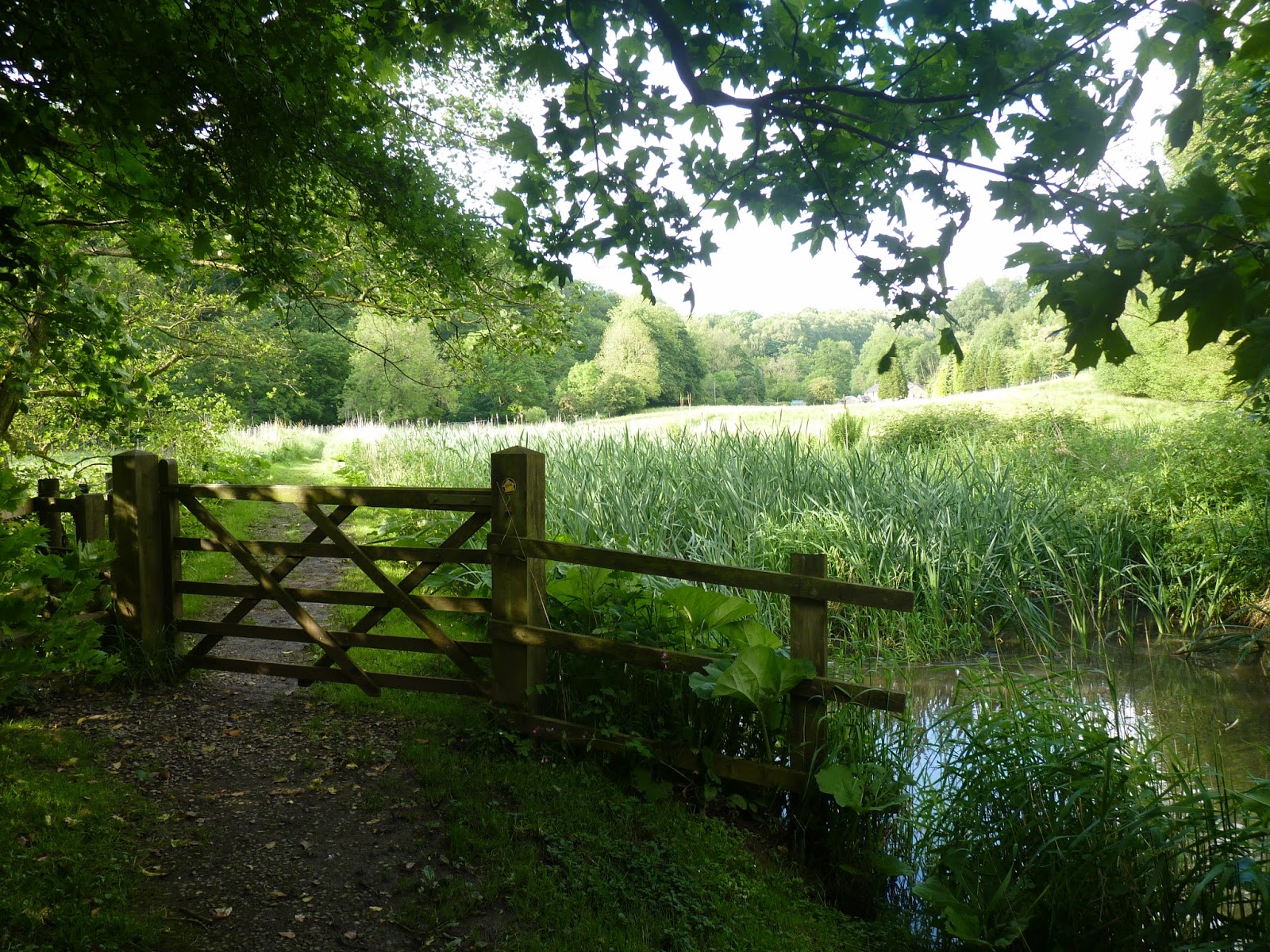 The noise from the main road is another distraction on this stretch and it is a relief to drop off the line - say goodbye, we won’t be seeing it again - and head back to a waterway once more. This time it’s the River Dane that will accompany us - almost to the end of the whole expedition - and again it is a path to be savoured. We drop off the old railway, cross a field and that noisy main road and enter a buttercup-filled field that is our route back to peace and quiet. Rather than heading downhill to the river, though, we go straight ahead and ever so slightly uphill where we will find another canal feeder - wider, this time, than the one between Leek and Rudyard. Where that had run quickly and surprisingly clear, this time it is slow-moving, if not stationary, and is choked with weeds and reeds and rushes. This does attract insects such as dragonflies and in turn ensures a vibrant birdlife - I was especially pleased to see a number of goldfinch, attracted no doubt by the presence of teasel, to which they are particularly partial.
The river is initially kept at arms length, occasionally viewed through the trees that line the towpath. At the risk of sounding like a purely fair-weather walker, it was a blazing hot day when I first walked this path and I was glad of the shade these trees provided. Whilst it felt less of a river walk, the presence of the water to my right also seemed to give a cooling presence and with no problems of navigation (and there have been so few of them along the route) I was happy to potter long at a steady pace, looking around me and taking things in. It was a May morning and the hawthorn blossom was at its height, coating the hedges and bushes in a froth of flowers in white and light pink. I’d gone into work for a couple of hours in the morning to sort out a couple of issues and they were still on my mind when I set out, but this abundance of flora and dappled sunlight meant I was soon distracted and by the time I’d got back to the car the problems had all but disappeared. And this, of course, is one of the reasons that we do walk - there is little more conducive to peace of mind than nature and to be bang in the middle of all this countryside is the best therapy you can find for anything niggling away at the back of your mind.
It was quite a surprise to come across a house in the course of renovation, out in the middle of nowhere as it was. Whilst it would make a splendid residence, with lovely views and absolute peace and quiet, it would also be isolated and lonely. As so often before, a property that appeals enormously to me in theory would be dreadfully difficult to live with in reality.


It seemed to me that it was a mile before the path reached even a sign of another property. A thin metal footbridge crossed the river to the far Cheshire bank - like the Dove, the river here forms a county barrier. The bridge is known locally as Gig Hall Bridge, although I never known if there is still a Gig Hall or it has been lost in the mists of time. A path from the Staffordshire bank leads steeply uphill, eventually to a spot called Bearda Mill, somewhere I have always found bewitching, primarily by being on the road to nowhere and therefore only visited by those on foot or exploring aimlessly any interesting-looking diversion in the car. There has been a mill on the site since the fourteenth century, although the current building is clearly of a much later derivation. Whilst it has a wheel attached to the wall, it is unlikely that this is the true mill - the race running a little way further down the valley.

Entering Cheshire for the first time feels yet closer to the end of our journey - our third and final county, although we shall spend still more time in Staffordshire before we are done. I dropped down to the water’s edge at the upper weir and drank deep from the apple juice in my water bottle. Across the Cheshire fields waves of bluebells cascaded down the slope, as though mimicking the white water to my right as it threw itself over the weir’s three steps with all the enthusiasm of a lemming. I let my eyes flow through 360° and looked up to the skyline on the Staffordshire bank, where I was taken aback to see two large marble lions on the hillside, staring out as though defying anyone from Cheshire to approach. I can only assume that these were on land belonging to the lovely Bearda Mill and can conceive of no reason for their presence other than the decorative for those of us wandering through the water meadows this bright May morn. Whatever the reason, they brought a smile to my face.
 As the river follows a wide bend, the footpath takes a more direct route across the fields. As I strode cheerfully along I spotted an elderly man making a much more stately progress alongside the water, a fishing rod in his hand, a waistcoat on his back and a floppy hat on his head. As I came nearer I noticed a number of artificial flies hanging from his lapel. We stopped to talk for a while and he told me that he’d been fishing the river for the last forty-eight years - his waders (heavily patched, I noticed) having been with him for the last forty-five. He told me he’d yet to cast a line this morning, but was enjoying his day out just as much as he would if he’d caught a dozen fish. He spoke of the mayfly hatch, and how late it was this year, and of how this dictated the type of fly he affixed to his line, and of when and where he would cast. I felt that he was more in love with the outdoors than with the fishing, and that the trout were merely an excuse to be out and about in the fresh air. I put this to him and he readily agreed, although this had not always been so - in years gone by it was all about the angling, these days no more than 25%. It was the longest chat I’d had with a fisherman along the way, and perhaps the longest I’d ever had, but by the time we parted I felt I understood a little more about the joys of a day spent fishing and the reasons why so many did it. His enjoyment was infectious, and when we parted my smile was still wider than it had been before we met.
Ahead of me lay the ponds and buildings of a fish farm, clearly quite a little business, although no-one was visible in any of the wooden buildings - a pity, really, as there was a notice suggesting ice creams could be purchased and the day was increasingly warm now that I had left the shady trees behind. Just beyond the farm were what appeared to be the main offices of the concern, along with a couple of holiday cottages. To the side of the furthest cottage was a shovel, so artfully placed that it must have been deliberate. Alongside was a stone tablet, engraved with two leaping trout and the inscription “1978 - Your valley, my dream, God’s gift”. The stone itself seemed a lot more recent than 1978, with neither moss nor lichen blurring the message, but it was clear that the emotions expressed were heartfelt and worthy of recording. I feel sometimes that we place more store in these type of inscriptions when they are aged by time and by weather but I had been charmed by little bits of artwork that dated from the last few years on more than one occasion since leaving Dove Head - and these will be the things that others will read in years to come and ponder upon in the way we do with eighteenth and nineteenth century artefacts today.
 The pathway continued on its way to meet the minor road between Swythamley and Wincle at the foot of a steep hill, with a spectacular single-arched bridge - the Dane Bridge - a hundred yards or so to the right. And whilst our way ultimately lies across the bridge I took a short detour up that steep hill to have a drink at The Ship Inn, two-thirds of the way up. The road is lined with terraced cottages, with more imposing properties the higher uphill you get; in years gone by they would have provided habitation for the workers at the paper mill that once stood on the far bank of the river, just below the Methodist chapel that (unlike the mill) still stands.
I’m never really sure if The Ship stands in Danebridge or in Wincle, although I note that its website gives the address as Wincle, but whichever hamlet claims it there is no doubt that it is almost as far from the sea as is possible in England - so why its nautical name? There is a little confusion over this. The pub sign shows “The Nimrod” in the Antarctic, Shackleton’s ship in his expedition before the famous “Endeavour” was trapped and crushed by the ice, necessitating the infamous open boat escape to South Georgia. The relevance here is the presence on the Nimrod of Sir Philip Brocklehurst, owner of the nearby Swythamley Hall. “The Swythamley” is another ship after which the pub may have been named - sadly, this sank off the Cape of Good Hope in the 1860s. A third theory is that it takes its name from a “shippen” - a sheep shelter in the local vernacular. Suffice it to say that the menus in the pub that day mention the “Swythamley” connection as the most likely.
There is a further link here with the 1745 Jacobite rebellion and the march on Derby that we had last come across in Mayfield, outside of Ashbourne. The story goes that an Alexander Maclean, having been separated from the retreating army, entered the pub for a meal, whereupon he was held at gunpoint by the landlord until the arrival of the local authorities. He was arrested, tried and sentenced to death - a sentence that was later reduced to a life sentence in a penal colony. The gun with which he was restrained was reputedly hung above the bar until the middle of the last century. Our way, as I’ve said, lays across the bridge at the foot of the hill, but there’s no hurry. Stay awhile and enjoy another drink and take in the many local photos and maps sprinkled around the bar area.

The name Brocklehurst is one that dominates the area, as befits the local lord of the manor - Swythamley Hall. The Hall itself is the reputed origin of the wallabies that used to be found upon The Roaches, just three or four miles away now - the story going that they escaped from the private zoo built up there between the wars. When finances forced the sale of the property out of the family it was apparently used for transcendental meditation - the organisation most associated with the Maharishi and The Beatles, the Natural Law Party and “yogic flying”. Unsurprisingly, it was sold on once more and is now a number of residential properties. At the gated entrance is Swythamley Chapel, a miniature towered church that is also now a private residence - it seems a pity, but is a terrific little building and is no doubt a lovely home.

Having passed a couple of small farms the path drops back down towards the river and enters another woodland. This is Back Forest, a gorgeous ancient woodland, far removed from the military style planting we have left behind us. Here there is a healthy mix of evergreen and deciduous trees, firs and birches, beech and spruce, with ample undergrowth. There is bracken, broom, bilberry, a splendid proliferation of plant life that provides a mixture of colours and textures and foliages to attract so many different types of wildlife - including, perhaps, the wallabies of which we have already spoken.
 The river cuts its way here through the gritstone that is now underfoot - the same gritstone that has helped to form The Roaches, Hen Cloud, Bosley Cloud and Ramshaw Rocks. It is a more resilient rock than limestone and gives a different atmosphere to those valleys we have seen earlier in the walk - closer to the early stages of the walk that to the middle. The path stumbles across tree roots and care is required in the placing of your feet to avoid any nasty falls. But the highlight of Back Forest requires something of a diversion away from the river. A pedestrian crossroads is reached and an initially steep uphill path is taken. After the initial steepness the path slopes away to the right - in effect cutting back on ourselves at a 45° angle - and reaches a gritstone outcrop known as Castle Rock. Whilst a scramble over this formation is to be encouraged, it is only part way to the true highlight so let us follow another track from here, cutting back to the left this time on a level contour. After a couple of hundred yards a gap in the undergrowth appears to the right and the path drops between massive stone walls and descends by a number of carved steps into a wondrous cleft in the hillside, some hundred yards long and twenty deep. There is room here for a couple of hundred people to hide, out of sight and with some degree of shelter. The name is reputed to come from either Luddites’ Church or Lollards Church - implying that it was a hideout for heretics of one kind or another (either religious or political) at some time in the dim and distant past. It is reputed to be the setting for a well-known mediaeval poem - Sir Gawaine and the Green Knight. So many stories attach themselves to this wild spot and yet I came across it completely unwittingly - a sign from the ridge above advising of a concessionary path to Luds Church suggesting to me something a little like the lovely Swythamley Chapel and hence worth a detour. And I trust that you have been as delighted with today’s little diversion as I was that balmy March afternoon all those years ago. Please be sure to wrap up, though - the temperature is at least a coupe of degrees colder than it is outside of the “church”.
My way now took a huge seven mile loop before returning to that pedestrian crossroads that I had left some twenty or thirty minutes earlier. If this seems a waste of energy, I should point out that no self-respecting route through the Moorlands could omit a traverse of The Roaches, the most visible and spectacular ridge in the county. Before doing so, though, I needed to clamber up that concessionary path to Dane Ridge. Once I had done so a right turn would have taken me back to Danebridge - a wonderful walk in itself; the left turn that I took instead strode along the ridge to a little notch at Roach End before rising again to the trig point at The Roaches' summit. The views from the first ridge were stunning in their own right - Bosley Cloud and the Cheshire Gap to the north-west, Shutingsloe slightly further around to the north, Morridge to the east and Gun Hill to the west. At the height of August these hills are clad in purple heather and on a sunny afternoon when butterflies are attracted to pollinate what must be the last of our wild plants to flower, they are truly spectacular.
 Beyond that little descent at Roach End a pitched stone path led uphill through gritstone rock sculpted by wind and water into weird and wonderful shapes - albeit not as weird or wonderful as some of the more imaginative names they've been given over the years (Bearstone is one such and takes a huge leap to see the bear within.) I could have taken the minor road to left or right and then come back along the ridge but in truth the road is a poor substitute and it is no hardship to retrace steps when the original steps are in scenery this good. As I strode higher the views became still more beautiful, eventually revealing the expanse of Tittesworth Reservoir stretching away towards the spires and towers of Leek - probably THE classic view in the Moorlands and once seen regularly in the opening titles of Countryfile. Paths criss-crossed the ridge here, weaving between rocky outcrops and clumps of heather as it sloped away to the east while falling sharply away to the west. Every so often I would disturb red grouse sheltering in the heather and watch as they flew away with their cries of "Go back, go back," their wings whirring away, seemingly too small for their dumpy little bodies. I was unsure who was the more startled, the grouse or me.
After a couple of miles I reached Doxey Pool, an allegedly bottomless pool inhabited by a malignant sprite named Jenny Greenteeth (face it, with a name like that she was never going to be on the side of the righteous, was she?) It's a pretty spot, with little to make me think that there was anything to be wary of but a Miss Florence Pettit was surprised here in 1949 as she wrote: "A great 'thing' rose up from the middle of the lake. It rose very quickly until it was 25 to 30 feet tall. Seeming to be part of the slimy weeds and the water, yet it had eyes, and those eyes were extremely malevolent. It pointed its long boney fingers menacingly at me so there was no mistaking its hostility. I stood staring at the undine, water spirit, naiad or whatever it was whilst my heart raced. Its feet just touched the surface of the water, the weeds and the air. When I dared to look again, the creature was dissolving back into the elements from which it had formed." Just in case, I made my excuses and left.

Shortly afterwards I took a path to the right that led downhill through a gap in the cliff edge, emerging into a small afforested area, mainly larches and fir trees but natural here rather than the man-made plantation I had noticed earlier. Sunlight glinted from a blue sky and threw shadows onto the rock-face, illuminating the large number of climbers scattered along the length of the cliff. This is one of the most famous rock-climbing areas in the Midlands and Pennine country, highly regarded for its classic climbs, pioneered by some of the sport's best-known names - men such as Joe Brown and Don Whillans. It is Whillans that the nearby British Mountaineering Council's hut is named after. The building adjoins and is partly contained by a natural cave in the rock and was previously occupied by one Doug Moller, the self-styled Lord of the Roaches and his wife Annie. Moller is/was a well-known local character and fought a long campaign with the Peak Park planning authority who wished him to move to more salubrious, healthy accommodation. After a dozen or so years an agreement was reached and the cottage was upgraded to its current use as a climbing hut.
 Beyond Rockhall - as it was once known - I turned left and re-climbed to the ridge. Obviously views heading
 north were different to the way out and it is remarkable just how far I could see from up here - Jodrell Bank, Fiddlers Ferry on the Mersey estuary near Runcorn, the Clwydian Hills of north Wales; Peckforton Hills were due west; and behind me now lay the blue-remembered hills of Housman's "A Shropshire Lad", the Wrekin above Telford and Cannock Chase. It seemed that everywhere I looked lay magnificent walking country, yet I was content to set The Roaches against any of them. This would be hard to beat.
At Roach End another well-made stone path descended into the depths of Back Forest once more, emerging at Black Brook - a little tributary of the Dane - and followed a narrow path to the right of a small water purification plant to the imposing Gradbach Youth Hostel. A former flax mill, it is now primarily a group-only hostel, although it is occasionally available for use by private individuals. It’s a lovely old building that dates back some 200 years - I find it hard to believe that some of the industrial units being built nowadays will still be standing and looking quite so good in the early years of the twenty third century. They built for posterity back in the 1700s! This time the mill was for silk - something that the area was particularly renowned for, with both Macclesfield and Leek being centres of excellence for the trade nationally.
 For the next half mile or so I had tarmac underfoot as I followed the single-track road towards the tiny hamlet ofGradbach itself (the youth hostel is at the end of a single track road that only serves itself, a couple of farmhouses and a small public car park). Immediately beyond that car park a well hidden wooden footbridge crossed another little tributary (this time it’s Red Brook, named for the colour ironstone imparts to it) and a cobbled footpath followed a curve in the Dane before coming out onto another quiet road. A left turn and another Methodist chapel came into view. It made for a pretty view, with a hump-backed bridge over the Dane immediately in front, but gave little impression of being used for anything other than a very occasional service.
I passed by the chapel, but only by a few yards, another footpath snaking away to the right through a drystone wall and a number of foxgloves. Before I took the path though, my attention was caught by a little plaque low down on the wall.
“In memory of Clifford Rathbone, The Stroller, 1907-1975. Writer and lover of the countryside. Author of Dane Valley Story, Goyt Valley Story and local historian. A tribute from his many friends.
Tread softly, all the Earth is holy ground.
It may be, could we look with seeing eyes,
This spot we stand on is Paradise.
Christine [sic] Rosetti”
A lovely tribute to someone who it appears was well-loved - Rathbone was editor of the local Macclesfield paper for a number of years and remains well respected within the town over thirty years after his death. The plaque would be easy to miss and it is almost better that way - it is to be appreciated by those who walk with their eyes open in this beautiful countryside and on such a glorious spring day as I was enjoying there is an argument that there are few places more worthy of the description “Paradise”.
To the right of the path were a couple of cottages, the closest of which was Dane Cottage, the garden to which was looking extremely well-tended. A cherry tree overhung the wall between us, as did some particularly tall foxgloves, and the hanging baskets were a picture. Yet another house you’d be pleased to call home in the summer but may find a little bleak in the wind and rain of winter.
 There followed a steep climb between gorse and bracken, the sound of the river clearly audible although it was getting further and further away as I gained height. The path emerged onto a farm track and into the Paradise of which Rosetti spoke. Spikes of foxglove once more lined the track with far-reaching views of dry-stone walls, hidden valleys, rocky tors, Ramshaw Rocks, Roche End, field upon field, and fluffy white clouds. Barns and cottages dotted the landscape, bleating sheep and a flock of crows provided music for the eyes and ears and a sudden movement upon one of those walls revealed the unexpected pleasure of a barn owl perched a hundred yards away, keeping a beady eye on what was going on in the long grass of the meadow beyond. I watched him for a couple of minutes, before he was up and away, quickly dropping out of view into the valley below. Unexpected, yes, but the undoubted highlight of the day.
A little way along the track came Bennett’s Sitch Farm, and a sign advertising “Plants for sale in aid of church funds. Please come and browse.” Given the paucity of passing trade, it seemed optimistic in the extreme to expect a great deal of trade - especially as most of the traffic would be on foot and it is unlikely that many walkers would have the inclination to carry a pot of geraniums or whatever for the rest of their route. Nonetheless I hope the sale was a success and wish them well with the venture. The “Sitch” mentioned in the farm’s name - and in Goldsitch Moss, the open ground between Gradbach and the Roaches - is another word for a stream, common in mining areas. This is appropriate here as the immediate vicinty is Staffordshire’s northernmost coal mining area, albeit on a far, far smaller scale than in The Potteries or Cannock Chase areas.
A little further on the road curved uphill to cross Robins Clough, passed another farmhouse and then descended once more. There was more birdlife sunning itself on the drystone wall here - a wheatear bobbed up and down as it displayed the white tail that gives it its name (it wasn’t always the ear that was white; there was originally an -se on the end of the name, from the Anglo-Saxon). It’s a dumpy little thing, but utterly charming, and again brings a smile to the face.
 Having passed another couple of farms the road turned away to the left, with a clearly defined sandy track trailing away to the right. It was a rocky path but easy to walk and the great beauty of it was that it brought me back down to the water level. On that May morn I was met by a group of about seven or eight teenagers as I descended here and stepped aside to allow them to pass. They also stopped and pushed forward the young lady with the map-case and the questioning expression - could I, she asked, point them in the right direction for Three Shires Head. I could - it was a couple of hundred yards behind them, where they’d crossed the packhorse bridge. She nodded, she’d thought as much but had been outvoted. Did that mean they were on the right path for Gradbach. They were - I’d just come from there and could describe the route and the signs for them to follow. They asked why it was called Three Shires Head and I explained to them - see below for details - and they were kind enough to express an interest. Reassured about their route, they thanked me and then agreed amongst themselves that here seemed a perfectly acceptable place for lunch . And so I ploughed on with their gratitude ringing in my ears.
Arriving at the bridge - just out of sight around a bend - I came across another group of similar ages, this time sat down and opening their rucksacks and pulling out packed lunches. The first of them looked up at me and asked if I’d seen another group. On hearing that they were only minutes ahead, and had paused for lunch, he happily relayed the information to his cohorts. They were, it transpired, all undergoing the expedition for their Silver Duke of Edinburgh award and there was a degree of competition between the groups. I was pleased to see a cricket bat attached the backpack of my inquisitor but didn’t hold out much hope for him finding a decent wicket up on he roaches where they were intending to camp overnight.


Anyway, having planned to dine at Three Shires Head, I saw no reason to change my plans and ambled over the second - smaller - bridge and plonked myself down on the rocks. It may be stating the obvious, but Three Shires Head is the place where three counties meet - Staffordshire, Derbyshire and Cheshire. The Dane is crossed by a wonderfully graceful single arch above a little waterfall which drops into a deepish little plunge pool - Panniers Pool, from the panniers, jaggers or tradesmen who would rest and take on water here. To the left, looking upstream is Cheshire; to the right, Derbyshire; and across another bridge, this time spanning a little tributary, lies Staffordshire. Both bridges show evidence of having been widened over the years to enable more traffic to cross in comfort. Historically, though, the area acquired a dubious reputation as the favoured hideout of fugitives from justice. In years gone by the jurisdiction of county sheriffs was limited to their own county. Thieves, murderers and various other blackguards would linger in the vicinity, ready to cross to one of the other counties as the long arm of the law closed in upon them in the knowledge that there was little the lawmen could do to bring them to book once they were across the appropriate bridge. Nowadays it is a magnet for walkers, artists and photographers - I have, in my bedroom, a watercolour of the classic view from the rocks where I sat and ate lunch today; a cursory search on the internet brings up thousands of photographs taken from the same spot; and rare is the day that you have the place to yourself. It IS special; but is far enough away from any roads to deter those who are not appreciative of its qualities.
 Lunch over and done with, I set off again - heading downstream now, almost retracing my steps on the opposite bank from this morning as I did so. My attention was caught by cries from the Cheshire bank and I glanced across to see the youngsters from earlier, still dining on the track where I had left them, calling to me and waving a greeting. It had been a pleasure to talk to such polite and interested teenagers - if you were to believe everything that you read in the papers you would have feared for your wallet at the very least having engaged them in conversation but far from it. These youngsters were active and engaged, intelligent and sociable, friendly and having a good time - I was almost jealous of them, until I saw the size of their rucksacks and realised how heavy they must be! I waved back at them cheerfully and headed off uphill.
The path was once again a sandy one and made its way gently away from the river. A fork saw the right hand track descend to its side once more, from where I could cross over and follow a track up to this morning’s path, or alternatively take a pleasant stroll along the riverbank - sadly the path appears to disappear having passed through the back garden and orchard of quite the most glorious, if lonely, of converted farmhouses. My path, though, took the left hand fork and left the Dane behind - I turned and took one last reluctant farewell, for I was leaving the watercourse for the last time.
It wasn’t long until the path met tarmac, a narrow road that served only one or two farms and saw little traffic for me to worry about. It skirted a hill in a wide curve before ignoring a left turn and dropping slightly to the right. I was looking out for a “clapper” bridge across the little stream that runs down the right hand side of the road, leading to an indistinct path running through marsh grass and bilberry bushes as it climbed steeply uphill. The ground is almost always wet here, with peat overlying the gritstone bedrock, and I could see (or more accurately hear) a change in the birdlife - the red grouse is the predominant feathered friend here, its cry of “Go back! Go back!” being almost commonplace. On one occasion I’ve seen a stoat chasing a rabbit here, dodging from side to side as he sought to keep hard on the heels of the rabbit as it feinted this way and that in a bid to escape that was to prove ultimately forlorn.
Cresting the top of the hill, I passed through another gritty rock formation - this feeling almost like a miniature quarry, as its straight lines gave the impression that stone had been hewn from here since time began. This was Wolf Edge - yet another sign of the historical presence in the area of mammals long lost to these shores. I wasn't far below Staffordshire’s highest summit here, Oliver Hill being nearly 1700 feet above sea level a quarter of a mile to the east. It’s quite an area for height records this - I'd soon hit the village of Flash (highest in the country) with its New Inn pub (second highest in the country) and would soon be back at Flash Bar Stores (highest shop!) Height itself is only a number, though; without it being a wonderful country, its height would be completely irrelevant. And it is a wonderful country - a bleak, windswept, infertile, inhospitable, downright beautiful countryside that was worth lingering over as I neared journey’s end.
 Dropping off the edge I followed a final track bounded by dry stone walls into the village of Flash itself. Its place as the highest in England has earned it a notoriety that it does not truly deserve. Its position, tucked in below Axe Edge but exposed to the worst that the elements can throw at it, mean that the buildings huddle together, presenting their backs to the open moorland with tiny windows minimising heat loss. It appears like an insular little community nowadays, but in years gone by was even more so. At one time in the eighteenth century it was renowned for the counterfeit coins produced here - hence the term “flash money” - and also had a reputation for both cock-fighting and bare knuckle boxing long after both were outlawed. It apparently was also instrumental in the spread of Methodism throughout North Staffordshire - a case of religion and geography being made for each other maybe.
As I passed by the parish church of St Paul’s, the Travellers Rest and Flash Bar were little more than a quarter mile away but the trip down the A53 would be a poor way for such a splendid trip to finish, so I delayed the end by a half hour or so. A public footpath to the right, not far beyond the church and village school, descended past an equestrian centre and over a couple of fields to cross the A53 - taking care as this is regularly revealed as one of the most dangerous roads in the country, although the nearby Cat and Fiddle road to Macclesfield is even worse. On the far side a gravel road dropped sharply and described a wide curve. My way lay along a well-defined track to a renovated cottage (Nield Bank), crossing the nascent river Manifold on the way. Beyond the cottage the path angled slightly uphill, grassy underfoot now and less well-defined but making an ideal resting place to just lie back, enjoy the view and the wind in my hair and reflect on the last sixty miles or so.


The Dove was wonderful as far as it went - the early gritstone quickly giving way to the limestone reefs of Chrome Hill, Wolfscote Dale and Thorpe Cloud before the valley opened out towards Ashbourne - but after Rocester it would have been difficult to keep close to the river and would have lost a lot of the attraction. The Churnet introduced the railway line and a different sort of history - more industrial, less rural - and so changed the feel of the walk. Alton and Dimmingsdale showed the impact that one man's vision could have on the landscape and though they took me away from the river were a highlight of the mid-section of the walk. Joining the canal at Froghall and accompanying the steam railway to Cheddleton brought the industrial age and the regeneration of these transport links in the late twentieth century for a society desperate for leisure. The canal to Leek was a diversion away from the direct route and to be savoured for that, a peaceful interlude after the clamour of the railway and led to Leek, the Queen of the Moorlands and an hour or twos exploration of this gem of a market town. The canal feeder to Rudyard was a delight and the reservoir a joy to stroll. Rushton Church was the single best building, partly for being so entirely unexpectedly wonderful an interior and the second canal-feeder - to Danebridge - was solitary walking at its best, quiet and scenic, whilst the Dane through Back Forest was deservedly popular but those trees could hide an army (or a herd of wallabies!) Luds Church is always a surprise, even when you know what to expect and has yet to disappoint me and The Roaches are deservedly renowned and probably the highlight of the route. The hills above Gradbach were far from flattered by the Paradisiacal description "borrowed" from Christina Rosetti and in leading to Three Shires Head brought me to a spot deservedly loved by walkers, artists, poets, photographers and me. In returning to Flash Bar the route had taken in some sixty-odd miles of the Staffordshire Moorlands, visited both Derbyshire and Cheshire and followed three of the most attractive rivers that the country has to offer; had taken in lovely historic towns, villages and hamlets; seen countryside beloved of Wordsworth, Byron, Ruskin, Walton, Cotton and many, many more; provided ample interest in the form of flora and fauna, art and history; and had been responsible for a raft of memories to store away and treasure. It had truly been a pleasure to walk and had given me plenty to think over in the Travellers Rest, so I wearily made my way to the minor road at Summerhill, turned left and completed the last four hundred yards and started planning the next expedition.


No comments:
Post a Comment